
The best hikes in southern California take you through some of the most fascinating and diverse landscapes you can imagine making the golden state one of the favourite playgrounds for outdoor enthusiasts and nature lovers.
From arid landscapes home comprising pretty dunes to snow-capped peaks and roaring waterfalls to stunning cliff tops overlooking gorgeous sandy beaches, you can experience the rugged wilderness on these beautiful south California hikes.
Since southern California is known for its hot, dry climate and the best year-round weather, you can plan these weekend hikes any time. The best way to admire and experience the coastal cliffs, snowy peaks, distinct desert vegetation, gorgeous waterfalls, and lush forests up close is to get on the many hiking trails.
Plus, whether you’re looking for easy and short hikes to enjoy with kids and pets or strenuous climbs that challenge you, there are many hiking trails in southern California with something for everyone.
Whatever you choose, you will come away witnessing some of the fascinating landscapes and beautiful panoramas on your trip.
In this post, we cover the best beach hikes in southern California, the best desert trails, hiking through some national parks amidst mountains and waterfall hikes in southern California, things to know, and what to pack and expect to help you plan a safe and fun adventure.
Read on to plan your adventure. Below are other ideas for your California trip.
THINGS TO KNOW FOR THE BEST HIKES IN SOUTHERN CALIFORNIA
CONTENTS
Here are some of the things to know while going on any of the best hikes in southern California.
Watch out for poison oak and ticks – Poison Oak is rampant in some countys, especially along all the trails, along with ticks and other insects. Do not touch any plants and it is best to wear long trousers even during the summer to avoid contact with poison oak.
Cell Service is not great everywhere – On some hikes, there is limited or no cell service, so it is best to plan accordingly
Download maps for offline use – Due to limited cell service and inaccurate GPS, it may be difficult to navigate. It is best to carry offline or physical maps wherever possible
Carry cash, and snacks – Some places may not accept credit cards, especially in parking lots. So carry cash. The same goes for snacks and drinks. Carry sufficient snacks like protein bars, fruits and nuts for munching as there are no amenities.
Check for road closures and forest fires – Due to forest fires, some trails get closed. It is best to check online for information about the current status of the hiking trails before you plan your trip. The same goes for roads if you are driving in the area.
Carry layers – It is surprising how many underestimate or do not take into account the chilly evenings in California.
No matter what time of the year, dense forest trails and mountain top areas are cold and windy as the evening sets in. So make sure to carry a warm wind jacket with you.
The best months for hikes in Southern California – May through October are the popular months for enjoying hiking near southern California. But if you want fewer crowds, I would suggest the shoulder months of spring and fall.
BEST HIKES IN SOUTHERN CALIFORNIA
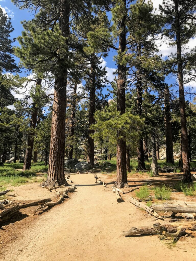
SOLSTICE CANYON TRAIL, SANTA MONICA MOUNTAINS NATIONAL RECREATION AREA
- Location – Malibu
- Distance – 3.2 miles one way
- Duration – 4 to 5 hours
- Difficulty – Moderate
- Trail Type – Loop
- Trailhead – Solstice Canyon Trailhead
- Total Elevation Gain – 676 feet
- Permit Required – No
If you are an avid hiker looking for the best hikes in Southern California, check out the Solstice Canyon Trail, nestled between the lush forest of Santa Monica Mountains National Recreation Area in Malibu and at a one-hour driving distance from Los Angeles.
The 3.2-mile loop hike trail offers incredible ocean views all along the way, and the best part of the trail is a small cascading waterfall for you to refresh towards the North end of the path.
The trail is also popular among the locals for its ruins of the rustic house, Roberts Ranch house. It was built in the 1950s but was sadly brought down by the wildfires in the 1980s. You can witness the outline of the pool area and a few more features covered with local flora.
On the way to Roberts Ranch house, you will pass by Matthew Keller House, another rustic cabin and an old massive oak tree.
Picnic benches are nearby if you plan a picnic lunch along with the hike. Check out the beautiful creek that runs along the house most of the time, adding rugged glory to the scene.
The trail is almost flat, and you can comfortably hike in your sneakers. I recommend starting the hike from the left side of the track (anticlockwise) if you want less elevation change, especially if you plan the waterfall point as your turn-back point.
Solstice Canyon Trail ascends in the parking area near the Pacific Coast Highway, and you can head back to the starting point via Rising SunTrail, a 4-mile trail for stunning views of the canyon and the coast. The place is usually crowded since it is popular and is open throughout the year.
To reach the parking lot from Highway 1, take a deviation on Corral Canyon Road.
SAN JACINTO PEAK, MOUNT SAN JACINTO STATE PARK
- Location – San Diego
- Distance – 12 miles one way
- Duration – 2 to 3 hours
- Difficulty – Challenging
- Trail Type – out and back
- Trailhead – Palm Springs Art Museum
- Total Elevation Gain – 10,250 feet
- Permit Required – San Jacinto Wilderness Permit
One of the toughest yet best hikes in Southern California is the Cactus to Clouds hike to the summit of Mount San Jacinto.
Located East of Los Angeles near the Palm Springs, Mount San Jacinto has an elevation of 10850 feet and is supposed to be the tallest peak in SoCal, with 21 miles of beautiful hiking trails overlooking the Alpines.
The Cactus to Clouds trail, also known as the Skyline Ridge Route, a 14-mile trail, as the name says, starts amidst cacti in the desert behind the Palm Spring Art Museum. It is recommended that only experienced hikers should try this trail.
Take the steep 8-mile path from the Palm Spring Art Museum to the Long Valley. You will find a ranger station there, and you need to buy a wilderness permit at this point.
From there, hike further a couple of miles towards the Round Valley. Take a pitstop to appreciate your efforts all this way! You will be hiking the last 3.3 miles of a brutal stretch from the Round Valley to reach the summit.
The trail is absolutely not recommended in Summer due to the fierce killing heat waves in the desert. At some point on the trail, you will not have access to water or any other sources, and you might feel terrible about the hike. So choose the months of May or October to have the best hiking experience in the region.

While heading back, you can descend until the ranger station and take up the Palm Springs Aerial Tramway to enjoy the bird’s eye view of the trail.
Alternatively, you can take the tram up to the ranger station in Long Valley if you want to avoid hiking. The most used summit aerial trail departs from the Upper Terminal of the tramway.
There is a cosy cafe near the tram station to grab a cup of coffee or enjoy ice cream overlooking the incredible views of the summit.
You can set base at Idyllwild, another rugged way to explore Mount San Jacinto. Take the Pacific Crest Trail from Idyllwild to reach the summit. Explore the surrounding San Bernardino National Forest if you have spare time.
MOUNT BALDY
- Location – San Diego
- Distance – 11 miles one way
- Duration – 7 to 8 hours
- Difficulty – Difficult
- Trailheads – Devil’s Backbone Trail and the Baldy Bowl-Ski Hut Trail
- Permit Required – No
Mount San Antonio, famously known as Mount Baldy, is the highest point in the San Gabriel Mountains, and its namesake hike is possibly the most challenging trail in Southern California.
Located northeast of Los Angeles, the snow-capped Mount Baldy can be seen throughout Southern California. Mount Baldy is the highest point in Los Angeles County at 10,064 feet.
The hike is located in Angeles National Forest and San Gabriel Mountains National Monument, about an hour outside Los Angeles. It offers many surreal views if you are up for a challenging hike.

The peak of Mount Baldy is also a famous winter wonderland whether you want to play in the snow, sign up for winter adventures, or simply absorb the beautiful views.
Although it is possible to make a day trip, spend at least a weekend in Mount Baldy as it is one of the best hikes in southern California.
You will be rewarded with splendid views of the snow-carpeted San Gabriel Mountains and the views of San Diego, LA and San Bernadino.
There are two trails to the peak — the Devil’s Backbone Trail and the Baldy Bowl-Ski Hut Trail.
If you take the Devil’s Backbone Trail, there’s a ski lift that can cut down some miles. From the top, hike the 8 miles round trip to the summit.
The Ski Hut Trail, while only 8 miles, is the more challenging of the two. Gaining a sudden altitude, it is best to take slow breaths and soak in the splendid views.
After this challenging hike, you will be treated to excellent views of the panoramic landscapes, ranging from the ocean cliffs to deserts, from San Diego to Owens Valley.
Despite its difficulty, it is one of the popular hikes in the area, and if you plan to do the hike on a single day, it is best to start early.

It’s best to hike in the summer after June until the beginning of fall if you have zero experience hiking in the snow, as you need experience with crampons and hiking a mountain in the snow is not only more challenging but also very dangerous.
Also, come in layers as the weather is unpredictable no matter the time of the year.
If you are a seasoned hiker looking for an adventure, check out Ice House Canyon trail, a 10-mile challenging but gratifying loop offering some of the region’s best views.
If you are a seasoned hiker looking for an adventure, check out Ice House Canyon trail, a 10-mile challenging but gratifying loop offering some of the region’s best views.
MOUNT LOWE PEAK
- Location – Altadena
- Distance – 3.2 miles
- Duration – 1.5 hours
- Difficulty – Moderate
- Trail Type – out and back
- Trailhead – Eaton Saddle
- Total Elevation Gain – 295 feet
- Permit Required – No
Located at the Southern end of the San Gabriel Mountains, Mount Lowe Peak features some of the best hiking trails in South California.
In the late 1890s, a professor named Thaddeus Lowe had plans to get a railway line constructed in the area and hence the peak has been named in his honour. Currently, you can see a track from Rubio Canyon to Eaton Saddle.
There are a couple of trails to reach the peak. If you are prepared for an extra adventure, you can take the 6.5-mile longer Sam Merril Trail, which begins at the Cobb Estate. But if you are a beginner hiker, I recommend taking the Mount Lowe Trail via Eaton Saddle.
You will witness the ruins of an amphitheatre brought down by the fires years ago. While ascending the trail, you will pass through the Mueller Tunnel, about 100 yards. Vehicles aren’t allowed inside the tunnel currently.

The entire trail has rugged boulders of different sizes, which can be slippery. Admire the views of Mt. Baldy and Mt. Wilson as you ascend. There are viewing tubes from the 1800s which are still intact.
The main attraction of this trail is the swing on the top of the peak, for you swing literally above the clouds. Unfortunately, it either gets stolen or removed abruptly. Some avid local hikers constantly try to reinstall them.
Enjoy the distant views of Strawberry Peak, Catalina Island and the rugged cliffs overlooking the perfect sunset. Visit early mornings to see the beautiful dense clouds If you visit the trail during winter; you might even enjoy snow.
BRIDGE TO NOWHERE, SAN GABRIEL MOUNTAINS
- Location – San Diego
- Distance – 10 miles
- Duration – 2 to 3 hours
- Difficulty – Moderate
- Trail Type – out and back
- Trailhead – East Fork Trailhead
- Total Elevation Gain – 870 feet
- Permit Required – No
If you want to experience the rugged terrains of Southern California, head to the San Gabriel Mountains at a 1.5 hours driving distance from LA and try hiking the Bridge to Nowhere trail. The place is also nearby to the Mount San Antonio summit.
The 10-mile trail starts at the Coyote Flat at the end of East Fork Road and runs through canyons, creeks, Yucca and Chaparral shrubs and wildflowers, ultimately leading to the bridge.
You will see big horn sheep lazing around as you navigate this beautiful trail. It is nothing less than a fairy tale movie scene, making it one of the best hikes in Southern California.

The 120-foot bridge was established in the 1930s to connect San Gabriel Valley with Wrightwood. However, the road was destroyed by a flood and what remains now is only the bridge.
You can sit by the bridge and admire the wilderness of the San Gabriel Mountains from the foothills or take a refreshing plunge in the nearby mini pools on the North side of the bridge.
If you want more adventure, try Bungee Jumping off the Bridge, one of the top attractions along this trail. It costs approximately $100 per person.
Wear proper hiking shoes and clothes, as you will cross the river multiple times. There are occurrences of flash floods along this trail in odd seasons. I recommend trying this trail in the late spring or fall for a comparatively easier hiking experience.
You will need about 6-7 hours to get the best leisurely experience of this trail. There is an exclusive parking lot at the East Fork Trailhead. Collect your forest adventure pass and pop it on the dashboard.
COWLES MOUNTAIN HIKE
- Location – San Diego
- Distance – 3 miles
- Duration – 2 to 3 hours
- Difficulty – Easy
- Trail Type – out and back
- Permit Required – No
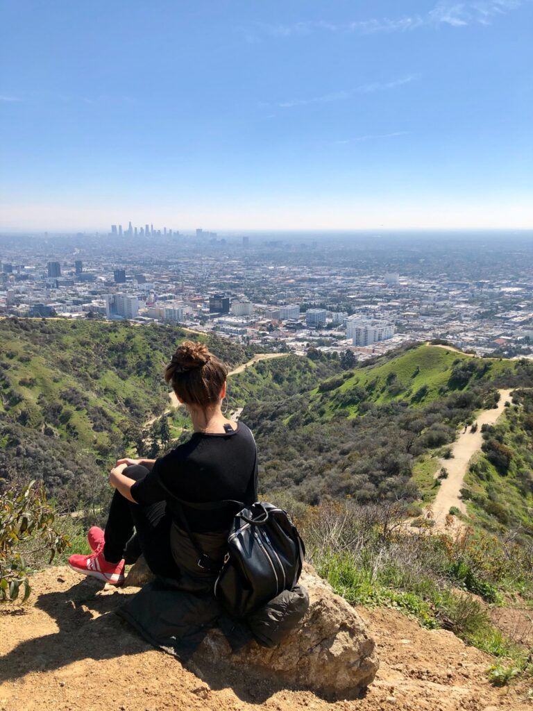
If you are looking for the best hikes in southern California, especially for gorgeous sunsets, head to Cowles Mountain, one of the most beautiful places to watch the sunrise in San Diego, the highest point in San Diego.
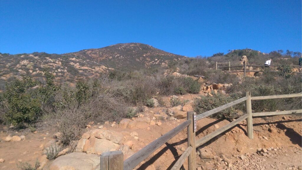
Cowles Mountain, located at about 1,592 feet, is a perfect location to watch the sunrise in San Diego, high above its bustling streets against the beautiful skyline.
It takes an hour to hike the 3-mile trail at Mission Trails Regional Park to get to the peak, where you can also take your dog. The track comes with a free parking lot and restrooms at the bottom of the trail.
You will be rewarded with gorgeous panoramic city views and the vibrant horizon that casts a magical spell of colours on San Diego.
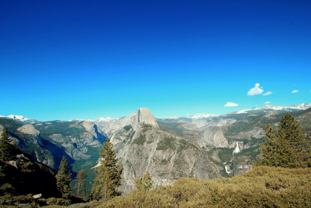
RECOMMENDED: 10 BEST PLACES TO WATCH SUNRISE IN YOSEMITE NATIONAL PARK
Cowles Peak is undoubtedly one of the best sunrise spots in San Diego to enjoy nature and beautiful mountain views.

You will also find many locals of San Diego running and walking along the trail leading to the peak of Cowles Mountain, as it is an excellent spot for a challenging morning exercise.
If you plan to take lots of pictures and videos, I highly recommend starting the hike very early to feel not rushed and leave room for watching the sunrise leisurely and capturing it on your lenses.
Ensure you finish the hike before 11 AM to be back below as the summit becomes too hot due to a steady temperature increase until 3 PM.
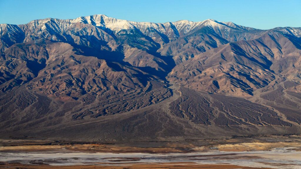
DEATH VALLEY NATIONAL PARK
Considered the hottest place on earth, Death Valley National Park is one of the best places to visit in California in December as it is the perfect month weather-wise.
Death Valley National Park, the driest and the largest national park in the United States, is located in Southern California along the Eastern border with Nevada.
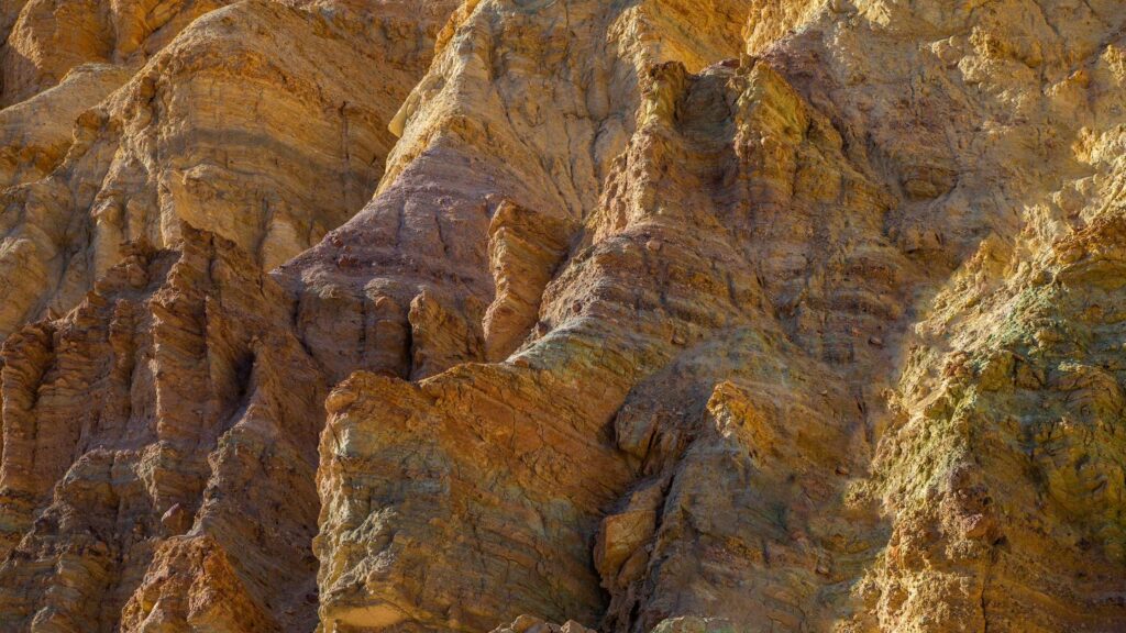
This 3 million-acre wilderness is renowned for stunning desert landscapes and unique vistas encompassing rugged mountains, golden canyons, orange dunes, colourful canyons, valleys, dry lake beds and salt flats.
The park is about a 5-hour drive from Los Angeles, and you can plan a long weekend at Death Valley Park to check out all the attractions.
If you enjoy hiking, you will find trails of all lengths and difficulty levels at Death Valley National Park.
From the official parking lot, you can do an easy walk right up onto the multi-coloured mineral deposits that are beautifully vibrant, comprising red, rust, gold, pink, lavender, and blue.
Walk out onto the Badwater Basin salt flats, one of the top landmarks, the lowest point in America.
Zabriskie Point is another must-visit attraction where you can enjoy the gorgeous views of the fantastic badlands on all sides. It is better to start your day by witnessing a spectacular sunrise at Zabriskie Point.
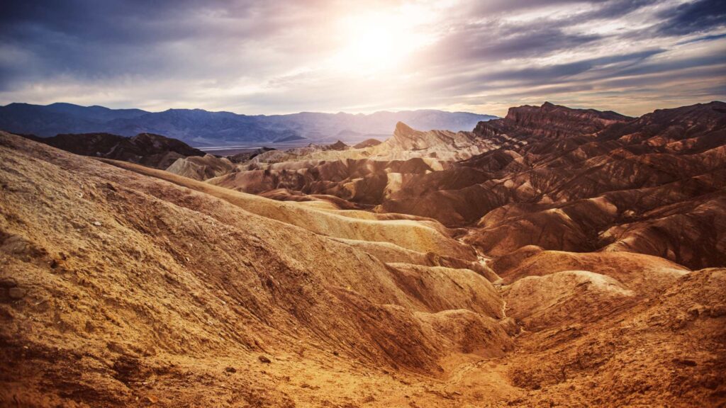
You can also hike the badlands near Zabriskie Point via the Golden Canyon trail.
The Salt Creek Interpretive Trail is a great starting point; a half-mile boardwalk trail navigates Salt Creek, where you can glimpse the resident wildlife, the Salt Creek pupfish.
If you prefer something more challenging, do the nine-mile Mosaic Canyon or head north in the park where Badwater Basin offers the chance to hike at the lowest point in the country at 282 feet below sea level.
Check out the stunning 100-foot dunes, the Mesquite Flat Sand Dunes, one of the few sand areas in the park. It is fun to walk on the dunes, but you will be doing a workout for sure.
For a fund adventure, climb to the top of Telescope Peak, the tallest point in the park.
At night, it gets very cold in this desert. Hence it is best to pack layers, especially if you plan camping.
Death Valley National Park is a fantastic time to be in December to watch beautiful stargazing and capture the incredible night skies on your camera.

WHERE TO STAY?
Despite being the largest park in the country, there are limited accommodation options in Death Vallet National Park.
The Inn at Death Valley is recommended if you want to stay in Death Valley National Park. Check more here.
Amargosa Opera House & Hotel is a 15-minute drive away and a great family option. Find more.
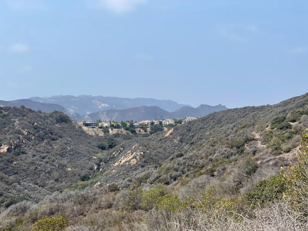
MALIBU CREEK STATE PARK
One of the best national parks in California, which offers you a wide variety of trails, from short and easy hikes to sweaty trails in Malibu Creek State Park. It is one of the best places to enjoy hikes in southern California, as something is available for everyone.
The park encompasses over 8,000 acres and features a 35-mile network of hiking trails, fire roads, grassy plains, oak savannas, and panoramic peaks.
Explore the gorgeous Santa Monica Mountains, backdropping Malibu on one of the many hiking trails.
Walk amidst the old ranch buildings and movie sets in Malibu Canyon.
For a proper hike, follow the main trail along the Creek spanning 10+ miles and plenty of places to stop, relax and enjoy the wide path. You will pass through a lake, swimming holes, and many viewpoints.
BEST HIKES IN SOUTHERN CALIFORNIA – BEACH HIKES
THE STRAND
Popularly known as Marvin Braude, exploring the Strand is one of the top things to do in South Bay. It is one of the long seabeach boardwalks to Santa Monica of South Bay starting from Redondo Beach.
One of the best ways to explore is to hike all the way, covering a distance of about 22km, from Will Rogers State Beach (nearly Malibu) to Torrance State Beach (nearly Palos Verdes); you can take the same beach boardwalk right along the sand. It is one of the most accessible hikes in southern California if you want to stroll along the coast.
You can also enjoy walking or rollerblading on The Strand, admiring the pretty houses and beautiful beaches. Many cycle rental shops close to the pier offer rental bikes at reasonable prices.
For the best views, plan your biking trip around sunrise or sunset. Also, stop by some of the local eateries to taste street food.
You can cover either Manhattan Beach Pier to Hermosa Beach Pier or the stretch from Hermosa Beach Pier to Redondo Beach Pier, each around 11 km if you want shorter hikes.
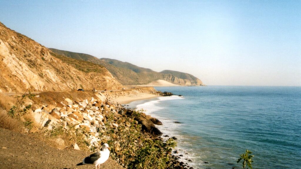
POINT MUGU STATE PARK
If you are a fan of national parks and nature reserves like me, one of the best hikes in southern California you will love is a getaway to Point Mugu State Park, a small area of protected land south of Santa Barbara located in the Santa Monica Mountains National Recreation Area.
Do not underestimate the size of this reserve as the park is packed with gorgeous landscapes, including forests inland running outward spanning five miles of coastline, which is more beautiful. The coastline edges are the most dramatic, with intriguing cliffs, rocky hills leading to dunes, and viewpoints.
Due to the climate and the fauna, spring is the popular time to visit Point Mugu as the valleys are filled with spring wildflowers carpeting lush green hillsides that give way to flowing waterfalls.
You can choose to hike any of the trails running for over 70 miles in the park that takes you through stunning landscapes, including the iconic Mugu Rock, Boney Mountain and panoramic views of the Pacific Coast Highway.
Most popular hiking trails are about 9 to 10 miles here, but if you are looking for a short one, take the Point Mugu trail, a 3-mile trail beginning from Big Sycamore Canyon.
Another trail begins from the beach, ascends the summit and returns to the shore. When you return, visit the beach and have a quick dip. It is one of the surfing hotspots, so if you wish to learn surfing, you can stay back and join one of the surfing schools nearby.

If you are into biking, you can pick those tracks that lead you to the beach line from inland, which is an adventurous trail for sure. Or head straight to the coast to enjoy the beaches where you can swim and surf.
How to get to Point Mugu State Park?
Point Mugu is about 50 miles away from Santa Barbara. Driving is the best way to reach it as the route includes a drive on Las Posas Road that runs straight to the ocean as it meets the Pacific Coast Highway.
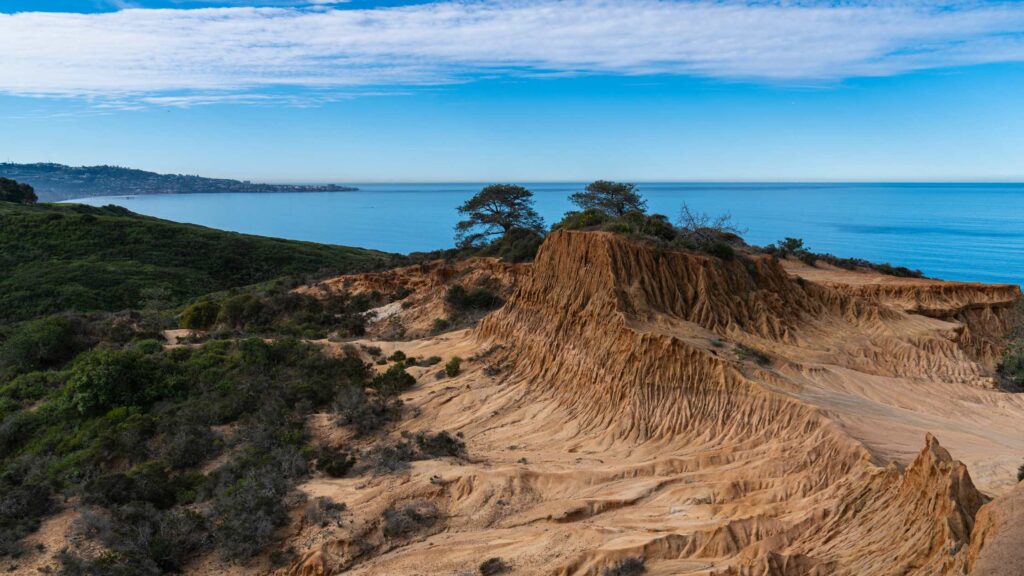
YUCCA POINT TRAIL, TORREY PINES STATE RESERVE
- Location – San Diego
- Distance – 2.5 miles one way
- Duration – 2 to 3 hours
- Difficulty – Easy
- Trail Type – Loop
- Trailhead – Razon Point and Yucca Point Trailhead
- Total Elevation Gain –125 feet
- Permit Required – No
If you want to hike in SoCal, check out the Torrey Pines State Preserve, a 2,000-acre paradise located North of La Jolla in San Diego.
Torrey Pines State Preserve is home to one of the rarest trees, the Torrey Pine Tree. The preserve features a lagoon, a natural habitat for migrating birds in this region.
The preserve runs along the coastal line, Torrey pines road and has many secluded points to enter the beach.

If you are a hiking enthusiast, you must check out the several beautiful hiking trails adorned with dense local flora. Most of these trails are less than a mile, and a couple can be combined for hiking on the same day, making Torrey Pines one of the best hikes in Southern California.
My favourite is the Yucca Point Trailhead, the only one with beach access. The entire trail is covered with sand, and the trail can be accessed either via the beach or the cliff parking lot. Follow the sign boards in the parking lot, which will lead you towards the distinctive rock formations, the Red Butte.
Admire the massive Torrey pines as you descend the trail. There are vantage points like Razor Point and Yucca Point, which offer stunning coastal views. The final part of the trail has 100+ steps that are carved along the golden Torrey Pines cliffs.
While hiking on the beach, you will be strolling next to these mighty sandstone cliffs, which are unstable. Touching them is highly not recommended.
Go Kayaking in the San Diego Bay if you have extra time, or rest on the rugged trails admiring the incredible views. You can head back via the South Fork or the Broken Hills Trail.
If you want a higher elevation overlooking the Pacific, check out the 1.2-mile Razor point trail or the 0.6-mile Guy Fleming Trail. You can do a dedicated 5-mile beach combing hike from La Jolla Shores to Torrey Pines beach if you are more adventurous.
The best time to visit the preserve is during the low tides so that you can hike on the beach. There is an exclusive paid parking lot where you can buy a day pass for $12- $15.
If you want a free parking space, park along North Torrey Pines Road near Torrey Pines State Beach, at a 10-15 minute walking distance from the reserve.
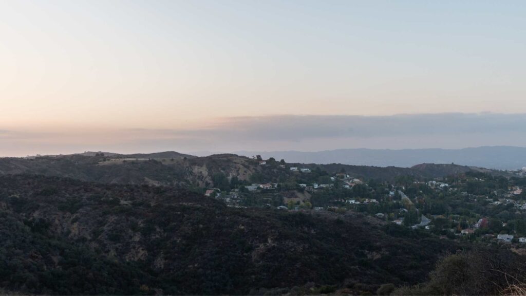
FRANKLIN CANYON RESERVOIR LOOP
- Location – Los Angeles
- Distance – 1.4 miles one way
- Duration – 1 to 1.5 hours
- Difficulty – Easy
- Trail Type – out and back
- Total Elevation Gain – 160 feet
- Permit Required – No
Nestled between Beverly Hills and the San Fernando Valley, Franklin Canyon Reservoir Park is a popular spot for hiking in California, especially with kids.
The 1.4-mile Franklin Canyon Reservoir Loop starts behind the parking area and ascends the canyon parallel. Most of the trail is shaded by trees and is a natural bird habitat, making it one of the best hikes in Southern California.

As you climb up the trail, you will be greeted with wooden steps to descend to the other side of the reservoir. Follow the sign boards and continue hiking along the path dotted around the reservoir and enjoy the beautiful views.
Check out the beautiful nearby Heavenly pond, where you can see Turtles floating around amidst the greens.
There is a visitor information centre if you want to learn more about the place.
BEST WATERFALL HIKES IN SOUTHERN CALIFORNIA
THREE SISTERS FALLS
- Driving distance from San Diego – 1.2 hours
- Parking – Free Parking at Canyonside Community Park
- Pets – Allowed on a leash
- Entry Fee – Free
- Biking allowed – No
- Permits Required – No
- Timings – 8 AM to 6 PM
- Hiking Time – 2 to 3 hours
- Distance – 2 miles of hiking to reach the waterfall
- Best Time to Visit – Spring and Winter
- Elevation gain – 1047 ft
One of the prettiest and second most famous waterfalls in San Diego is the Three Sisters Falls, located within an hour’s drive from the city.
The falls get their name from the three main drops, and they are best observed after a heavy rainy season.
A two-mile multi-tiered hike is required to see the tumbling three sisters.
The trail will be relatively hot during the summer, and this is one of those hikes where you will have to climb steeper sections on the way back. So bring lots of water with you and remain hydrated.

You may also encounter narrow trails with little to no tree cover canopies at specific track points, making it more difficult and ideal for experienced hikers. I wouldn’t encourage bringing children.
You can also try swimming at the Three Sisters; it is refreshing.
Pet parents, ensure your furry pals’ paws are protected from the heated trails.
I recommend starting your hike as early as possible during the day to beat the temperatures while on your way back, and try avoiding weekends.
To get to the park’s parking lot, you’ll have to drive around 8 miles on an unpaved road.
BIG FALLS
- Location – San Bernardino County
- Distance – 0.7 miles one way
- Difficulty – Easy
- Trail Type – out and back
- Total Elevation Gain – 112 feet
- Permit Required – No
If you want to witness one of the biggest waterfalls in SoCal, head to San Bernardino County to check out the Big falls cascading from a height of 500 feet amidst the lush forest.
You can reach the bottom of the falls via the main 0.7-mile Big Fall Trail. The falls plummet in tiers, and if you are more into adventure, you can try reaching the low-level tiers. It requires a bit of navigating through the boulders.

If you are not an experienced hiker, I recommend sticking to the main trail. The falls is so massive that you can take a glimpse of them from the main road and the parking lot.
The Big Falls will usually be filled with water throughout the year. During the monsoons, the falls create a 10+ tier structure, a visual treat that should not be missed.
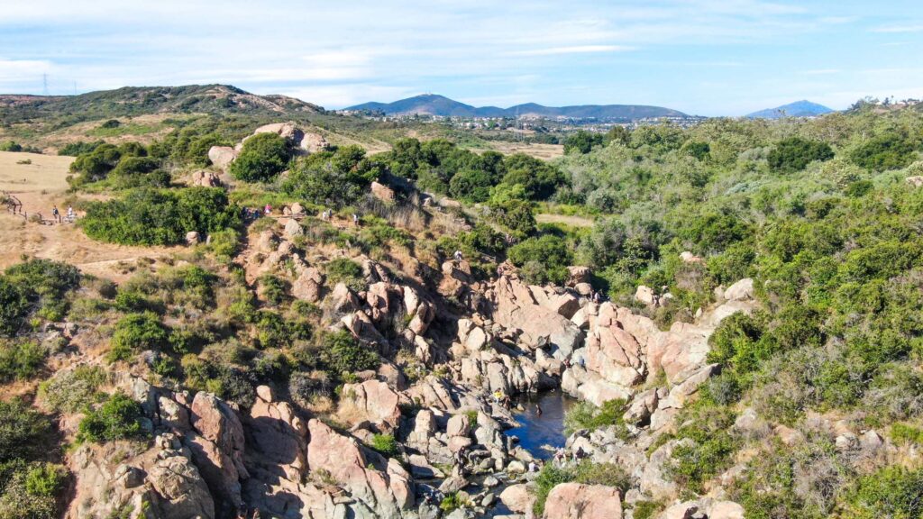
LOS PENASQUITOS CREEK FALLS
- Driving distance from San Diego – 30 minutes
- Parking – Free Parking at Canyonside Community Park
- Pets – Allowed on a leash
- Entry Fee – Free
- Prohibitions – Camping and loud music
- Biking allowed – Yes
- Permits Required – No
- Timings – 8 AM to 6 PM
- Hiking Time – 2 to 3 hours
- Distance – 6.8 miles of hiking to reach the waterfall
- Best Time to Visit – Spring and Winter
- Elevation gain – 147 ft
Los Penasquitos Canyon Preserve is spread across 4000 acres. It is home to Los Penasquitos Creek Falls, one of San Diego’s most well-known and oldest waterfalls, located about 30 minutes north of downtown.
It runs through a beautiful lush forest near the end of the loop trails on a volcanic spur in the heart of Penasquitos Canyon.
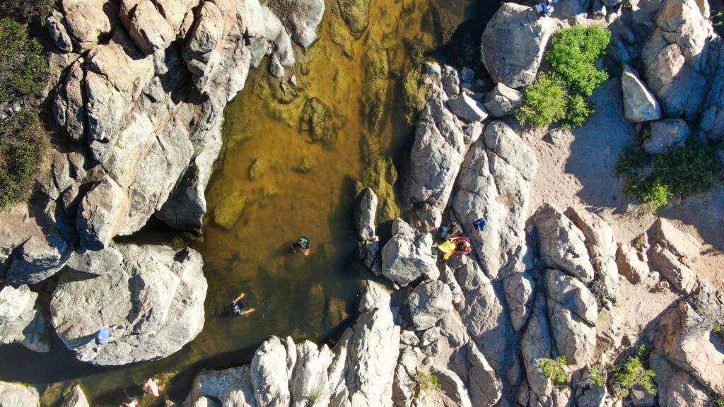
The waterfalls keep flowing throughout the year, and it is an excellent location to go if you’re seeking simple hikes to waterfalls in San Diego.
The trip to Los Penasquitos Creek Falls is straightforward and ideal for practically all hikers because the pathways are straight and well-marked.
You may witness a wide variety of vegetation and unusual bird species.
You’ll need to do a 6.8-mile loop hike in roughly 2-3 hours, including stops for lunch and a few more hours for a full-day adventure to reach Penasquitos falls.
Since the hike is popular, expect many hikers and mountain bikers. Bicycles are permitted on specified trails with a ten mph speed restriction.
This preserve, thankfully, is pet-friendly (dogs to be leashed). Keep an eye out for your fluffy chum, as the park, however, is home to rattlesnakes, coyotes, and mountain lions.
Because of the popularity of this waterfall and preserve, I would recommend going here early on weekdays to avoid crowds.
You must pay $3 if you use the parking lot on Black Mountain Road.
Recommended – 10 Top Places To Watch Sunrise In San Diego
WHAT TO PACK FOR SOUTHERN CALIFORNIA HIKES
For a hassle-free experience of hiking in southern California, it’s important to pack properly.
Depending on the time of year and type of trail you choose – whether you are heading to the beaches or waterfalls or deserts, modify below items accordingly.
If you’re visiting in the winter, rain is very common, and so is fog during the California mist season. Here’s a list of things you will need.
GENERAL ITEMS
- Hiking Boots
- Camping Sleeping Bag
- Wind Jacket
- Day pack
- Backpack
- Pocket-Sized Water Filter
- Reusable food storage bags
- Ultralight First Aid Kit
- Hiking Leggings
CLOTHING
The temperatures can be foggy during the day and they drop at night as the breeze increases.
As with camping anywhere, you need to be prepared for the unpredictability by going with many layers. Here’s what you need:
- Base Layer – Long Sleeve Sun-Protected Light Weight Top+ Light Weight Hiking Pants
- Insulating Layer – Light Weight Pullover
- Outer Layer – Light Weight Windproof jacket with hood or Insulating Light Weight Jacket for fall/winter weather.
CAMPING ESSENTIALS
Here are some of the camping essentials you will need:
- Cooler for food and water – Ultra Travel Cooler
- Camping Chair – Quad Camping Chair
- Camping Cot – Folding Camp Cot and Air Bed with Side Tables and Battery Operated Pump
- Sleeping Bags – Brazos Cold Weather Sleeping Bag
- Sleeping Tents – Ultralight Tent 3-Season Backpacking Tent 1 Person/2 Person Camping Tent
- Camping Lantern – Rechargeable LED Camping Lantern
- Backpack – Hiking Day Pack and Reusable Water Bottle + Light Weight Water Filter
Camping essentials for preparing food:
The best one I’d recommend is this Outdoor Master Cook Portable Folding Camp Kitchen along with this Light Weight Cook Ware and Backpacking Gas Stove Burner.
OTHER ESSENTIALS
Even if you aren’t into photography, you may want to bring a camera with a good lens.
I own a Panasonic LUMIX DC-ZS70S that I carry while camping since I prefer lightweight gear instead of my Nikon D850 which I use regularly.
MAP OF THE BEST HIKES IN SOUTHERN CALIFORNIA

- Why the Philippines is Becoming the iGaming Hub of Asia - May 24, 2026
- Cultural Immersion: Guided Paths into the Heart of a Destination - December 18, 2025
- The Best Destinations for Your First Solo Package Holiday - December 18, 2025


