
If you think Santa Cruz is only a surfer’s paradise or a beach-lovers haven, it is not true. Did you know that some best hikes in Santa Cruz are also the top trails in California?
Whether you are only here for a weekend or a quick stop, there are many best hikes in Santa Cruz for all types of hikers and nature lovers.
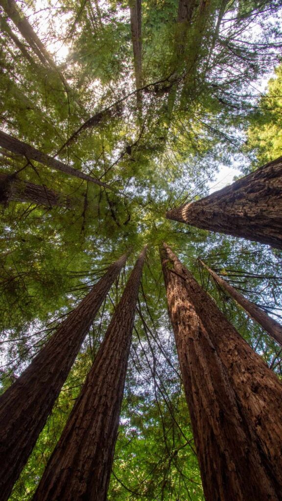
From mystic trails running through the heart of California’s most ancient giant redwoods to the jaw-dropping rugged coastline offering splendid views of the Pacific Ocean, the hiking trails in Santa Cruz are diverse and beautiful, offering something for everyone.
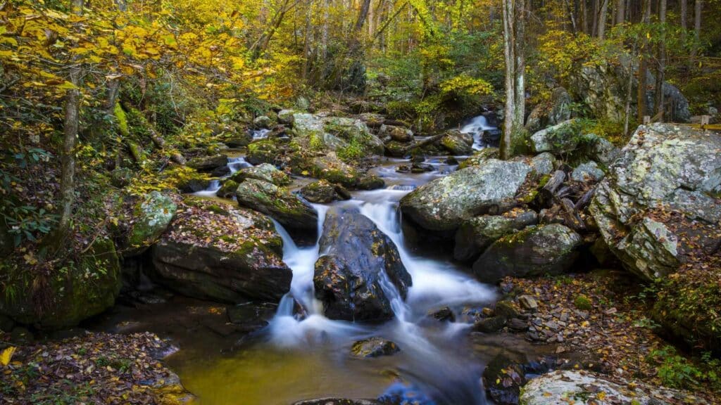
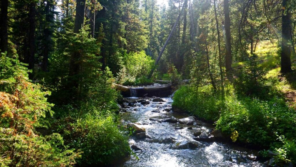
Thanks to its vast expanse of diverse terrains ranging from 2000-feet high Santa Cruz mountains to the long coastal shores, the beautiful hiking trails near Santa Cruz take you through different ecosystems comprising redwood forests, meadows, creeks, waterfalls, and beaches.
One of the best ways to witness the natural wonder found in California – the ancient forests of giant redwoods is to get on these Santa Cruz hikes.
Not just this, you can also choose from challenging, moderate, or easy hikes near Santa Cruz to find the perfect adventure for you.
Each hike is different, offering diverse views, so if you possibly do as many as these hikes in Santa Cruz, you can experience the gorgeous windswept coastal views and the enchanting forests on your trip.
Having done multiple weekend trips and longer trips in this region, I have shortlisted some of the best hikes in Santa Cruz that you can plan for your next hiking adventure.
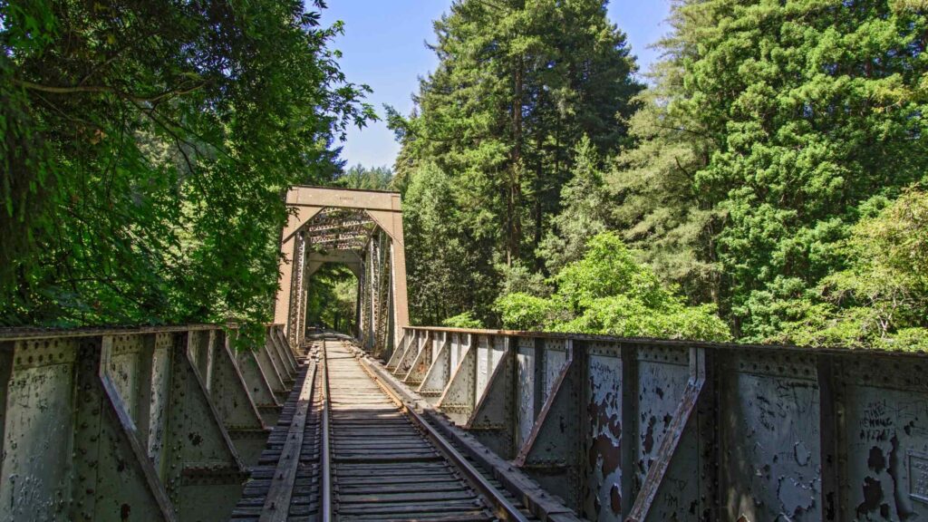
BEST HIKES IN SANTA CRUZ – WILDER RANCH STATE PARK
CONTENTS
Parking: Paid day-use parking, $10 per vehicle
Dog-friendly – No
Camping – No
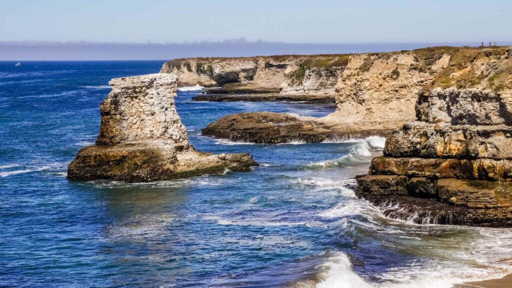
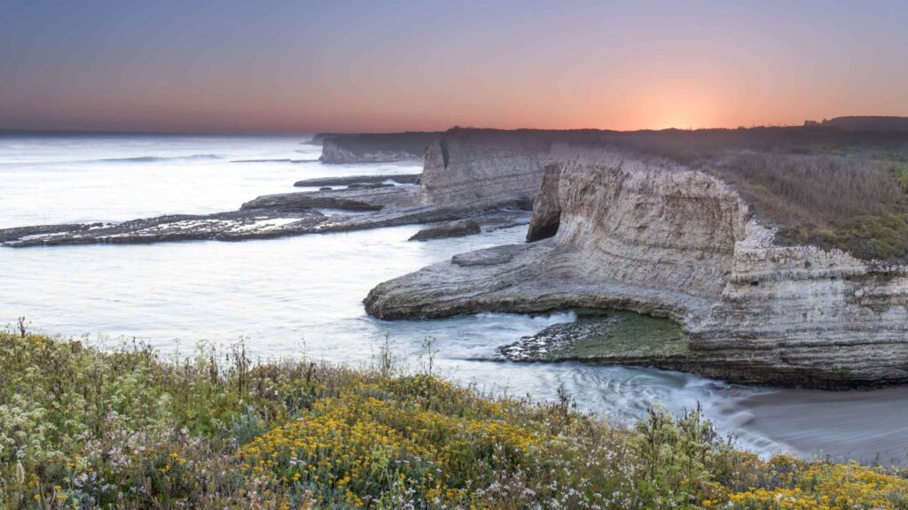
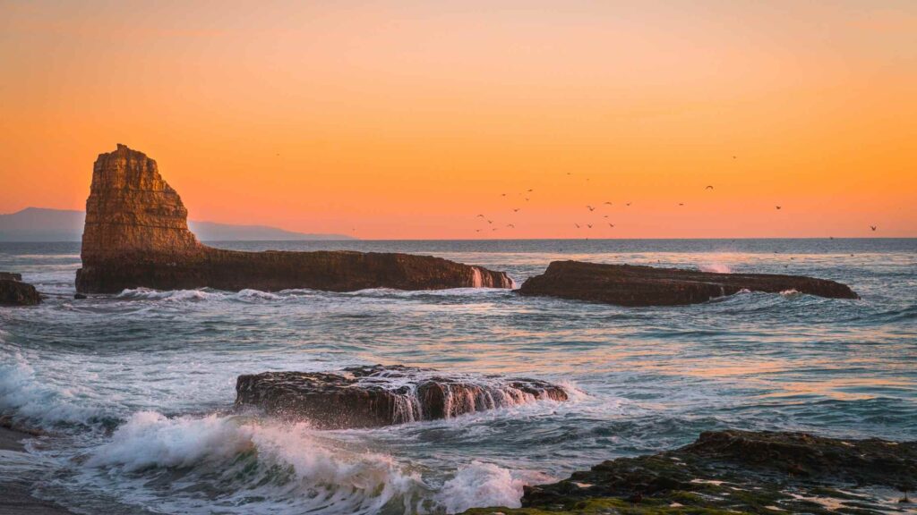
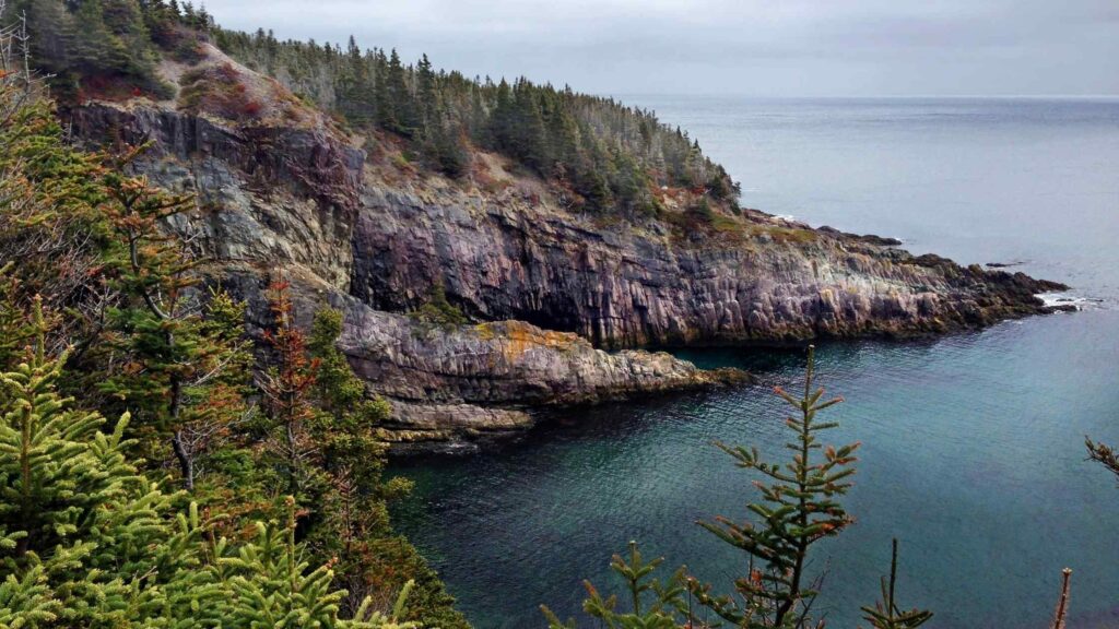
Wilder Ranch State Park is one of the best parks in Santa Cruz county if you are fond of coastal hikes.
This stunning 7,000-acre park, located next to Highway 1, runs for over 35 miles along the coast, featuring a magical forest and offers gorgeous views of Monterey Bay, coastal bluffs, and beaches.
No wonder it is a famous park for weekend getaways, RV travelers, mountain bikers, nature lovers and hikers.
It is also rich in history as the state park is an essential part of California’s ranching past.
The park, which was once a dairy ranch, offers you glimpses of its ranching history that you can see at the beautiful Victorian home, a farmhouse in Gothic style, a rodeo arena and a unique shop run by a water-powered machine – all built in the 1890s.
OLD COVE LANDING TRAIL
Distance – 2.3 miles
Difficulty level – Easy
Duration – 1 hour
Type – Loop
One of the best hikes in Santa Cruz is the Cove Landing Trail. Located within the Wilder Ranch State Park, it is one of the most accessible and most beautiful hikes you can do in the park.
The Old Cove Trail just takes an hour to complete making it popular among the hikers, mountain bikers and runners. Since the trail is mostly flat and easy, you can plan this trek if you are traveling with kids.
The Old Cove Landing Trail is known for its gorgeous coastal cliffs dotted with lush cypress groves from where you can witness the beautiful views of the ocean and hidden coves.
Recommended: 25 Best Hiking Trails In Point Reyes National Seashore, California
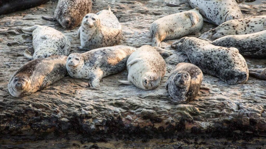
It is also a fabulous trail for watching migrating whales and birds like cormorants, snowy plovers, and seagulls.
The trail also passes by Wilder Ranch’s historic buildings, giving you peeks at lives in the 1900s. You will begin your hike near the Wilder Dairy Cultural Preserve.
You will pass through a cliff overlooking the ocean, which is a stunning view. If you continue the trail down to the fern grotto, you will be led to a cove and a serene beach.
You have the option to make the Old Cove Landing Trail into a 10-mile hike if you continue walking on the Ohlone Bluff Trail to reach Four Mile beach, which offers fantastic views of the coastline.
WILDER RIDGE TRAIL
Distance – 7.7 miles
Difficulty level – Moderate
Duration – 3 hours
Another among the top hiking trails in Santa Cruz is the Wilder Ridge Trail.
Located close to Old Cove Landing and Ohlone Bluff Trails, this trail is known for the spectacular views of the coastal bluffs and the forests. It is also a popular route among mountain bikers.
Pleasant weather and the option to head over to Monterey further make the trail convenient. The Wilder Ridge Trail runs for over 6 miles across rough terrain on the mountain slopes opposite Highway 1.
The trail includes some steep stretches, but it is a moderate hike that you can enjoy with a good pair of hiking shoes.
After about two miles of uphill hiking, you will be rewarded with views of the Santa Cruz Coastline and the Monterey Bay.
On the Wilder Ridge Trail, you can also check out the historical Wilder Dairy Cultural Preserve, which gives glimpses of exhibits on the park’s ranching history.
Also, check out the pretty restored 1870s barn home to fruit orchards and a blacksmith shop.
Recommended: 35 Awesome Things To Do In Point Reyes California
FOUR MILE BEACH TRAIL
Distance – 1.2 miles
Duration – 1 to 2 hours
Difficulty – Easy
Type – Out and Back
One of the most accessible Santa Cruz hiking trails is located in Wilder Ranch State Park. The pretty Four Mile Beach Trail is one of the popular trails for hiking near Santa Cruz with kids.
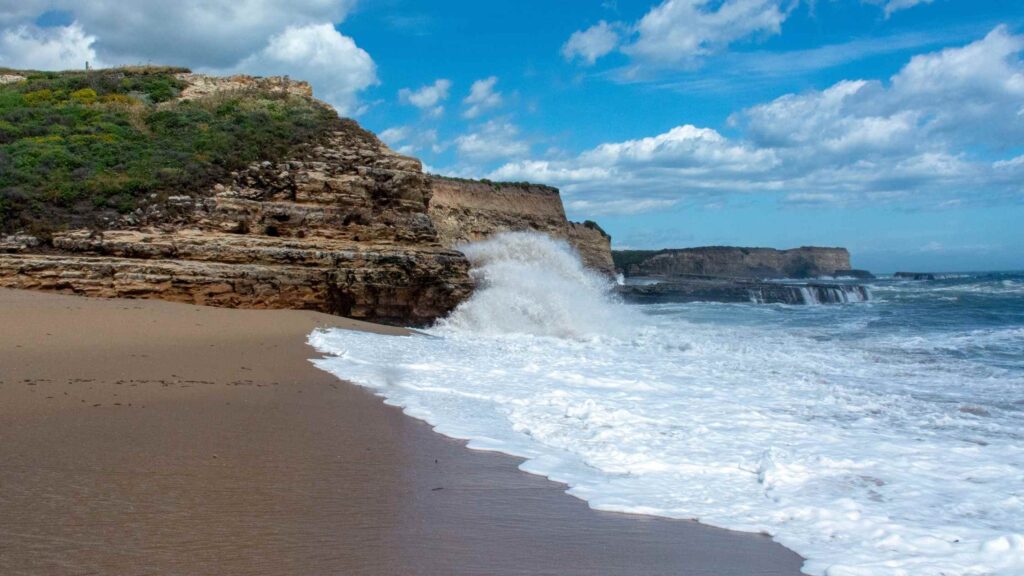
Four Mile Beach is an easy out-and-back trail leading to scenic Four Mile Beach, which begins at Route 1.
On the way, you can watch the land carpeted with beautiful wildflower blooms, especially during the spring and early summer.
Four Mile Beach is a famous picnic spot and an excellent beach for a swim, so come prepared for both.
But note that the tides are strong and may not be for you unless you are an expert swimmer. So if you plan to swim, it is best to check the tide charts.
Also, tide pooling is another activity to enjoy on the Four-mile beach. You can spot the rich marine life up close, including sea slugs and starfish.
ENCHANTED TRAIL LOOP
Distance – 5.1 miles
Difficulty level – Moderate
Duration – 3 hours
Trail Type – Loop
If you want to get glimpses of the Californian redwoods, one of the best hikes in Santa Cruz you can plan is the Enchanted trail loop.
The East Baldwin Trail is the best way to enjoy this Enchanted Trail loop. This trail goes through the thick forests, being true to the Enchanted Loop’s name.

You will enter the forest from the ocean and back, passing through giant redwoods, creeks, a beautiful meadow, wild mushrooms, and gorgeous wildflowers if you are traveling in the spring, including Indian paintbrush and aster.
It is also a fantastic trail for mountain bikers, and hence do not be surprised if you spot many speeding bikers on your hike.
SINGLE TRACK TRAIL
Distance – 13.1 miles
Duration – 6 to 7 hours
Difficulty – Difficult
Type – Loop
Although it is more popular among mountain bikers, the Single Track Trail is one of the best hikes in Santa Cruz if you are looking for an adventurous hike.
Located at Wilder Ranch State Park, this trail passes through the lush forests but also offers pretty views of the ocean.
Many uphill stretches make it for a challenging climb, but if you are game, you will be rewarded with the views of the wilderness and the coastal line on Single Track Trail.
BEST HIKES IN SANTA CRUZ – THE FOREST OF NISENE MARKS STATE PARK
Parking – Paid parking lots available, $8 day-use fee per vehicle
Dog Friendly – No
Camping Possible – No
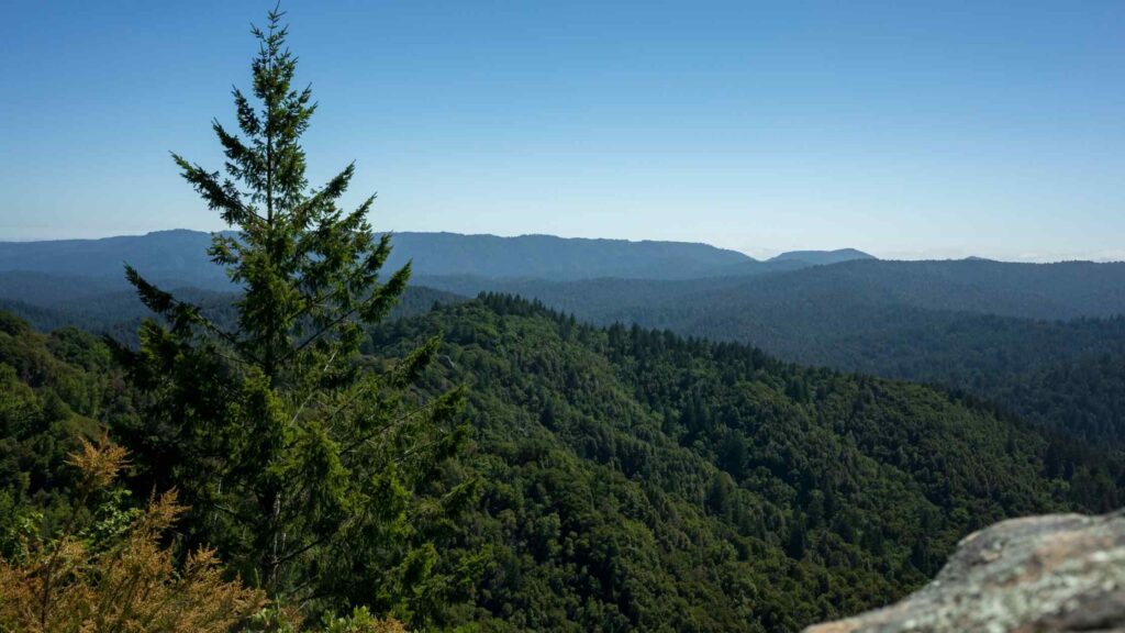
Spanning 10,000 acres and covering 40 miles of hiking trails, Nisene Marks State Park is the largest park in Santa Cruz County.
The Forest of Nisene Marks State Park is located at Aptos, away from the bustling city, comprising dense forests, giant redwood forests, and waterfalls making it one of the favourite areas to enjoy hiking in Santa Cruz.
OLD GROWTH LOOP TRAIL
Distance – 2.2 miles
Difficulty – Easy
Duration – 2 hours
Type – Loop
If you are looking for a short and easy, get on the Old Growth Loop trail, which is one of the best hikes in Santa Cruz in Nisene Marks State Park.
It is an excellent hike ideal for beginners to experience the highlights of the best of the State Park, as you will pass through the rich redwood trees, wild mushrooms, meadows, waterfalls and views of the Aptos Creek.
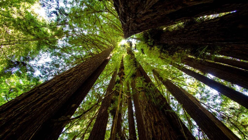
This trail is one of the few that takes you through the heart of some of the most impressive ancient redwood forests in California. You will spot many redwood giant trees at least a few thousand years old.
Hike through Marcel’s Forest, passing through the famous Advocate Tree to reach Old Growth Loop Trail. You can make a quick stop at the kiosks and look for the plenty of banana slugs around this area.
Continue your walk through the Split Stuff Trail and Aptos Rancho Trail to arrive at the Old Growth Loop, a beautiful path where you will come across waterfalls, redwood groves, and the ocean.
If you want a longer hike, continue on the side trails to reach Twisted Grove, home to mystic gnarled redwood trees perfectly embedded with the surrounding habitat.
Beware of poison oak on your hike. Also, note that it is one of the best hikes in Santa Cruz you can plan in winter. The bridge is closed during the rainy season, so keep that in mind before planning this trek.
MAPLE FALLS TREK
Distance – 7.7 miles
Difficulty level – Moderate
Duration – 3 hours
Type – Out and back
If you want a challenging trek in the Forest of Nisene Marks State Park, then one of the best hikes in Santa Cruz is the Bridge Creek Trail that leads to the beautiful Maple Falls.
The Maple Falls Trail is a 7.7-mile out-and-back hike that takes you through the lush redwoods, passing through creek crossings, meadows home to wild mushrooms and cute bridges, and finally arriving at Maple Falls.
Thanks to the beautiful 50-foot waterfalls, it is one of the most popular Santa Cruz mountain hikes.
The best time to plan this hike is in the spring, when Maple Falls is in full splendour. Note that the trail, in the end, can get muddy and slightly slippery at this time.
The hike starts from the Porter family picnic area. Take the Loma Prieta Grade Trail on the left, located on Aptos Creek fire road.
After half a mile into this trail, you need to turn right onto the Bridge Creek Trail. Follow this trail to the falls for another 3 miles.

The Maple Falls Trail starts easy and becomes moderate. You will pass through the dense redwood forest home to beautiful creeks creating gentle music to the ears and wildlife, including deer, squirrels, mushrooms, pine trees, and more.
APTOS CREEK FIRE ROAD
Distance: 25.8 miles
Duration – 8 to 9 hours
Difficulty level: Moderate
One of the secret hikes in Santa Cruz is the Aptos Creek Fire Road trail located at the Forest of Nisene Marks State Park.
This road is popular with long-distance runners, hikers, and mountain bikers.
The Aptos Creek Fire Road is the main hiking trail that takes you through the heart of the wilderness, reaching the farthest corners of the Forest of Nisene Marks.
You can get on this trail to connect with other long-distance trails, like the famous 2.5-mile Old Growth Loop Trail.
On this hike, you will also pass through the West Ridge Trail Camp, the park’s nearest and only camp.
Major attractions in the area include Five-Finger Falls and the Loma Prieta earthquake epicentre.
The Aptos Creek Fire Road has many challenging steep sections, one of the notable stretches being the climb near the summit of Santa Rosalia Mountain.
Here stop by to witness the beautiful panoramas of the horizon from the Sand Point Overlook overlooking the Pacific Ocean.
FIVE FINGER TRAIL
Distance – 20 miles
Duration – 5 to 6 hours
Difficulty – Easy/Moderate
Type – Loop
One of the longer hikes near Santa Cruz is located at Nisene Marks State Park, offering the adventure-loving travelers a hike to a beautiful secluded waterfall.
Although it is longer, this well-marked trail is relatively easy and ideal for beginner or intermediate level hikers. The best way to enjoy this trail is to start early.
The trail starts next to the entrance kiosk on Aptos Creek Road. Following this will take you to the Five Fingers Trail.

You can witness the rustic-looking second-growth redwoods, creek crossings, and epicentre of the Loma Prieta Earthquake before arriving at the pretty waterfall.
The best months to plan this hike are summer or fall as the other months mean the trail can be muddy and slippery.
Make sure to carry enough food, water, and also a headlamp.
BEST HIKES IN SANTA CRUZ – BIG BASIN REDWOODS STATE PARK
SKYLINE-TO-THE-SEA TRAIL
Distance – 30 miles
Duration – 2 to 3 days
Difficulty – Easy-moderate
Type – Point to Point
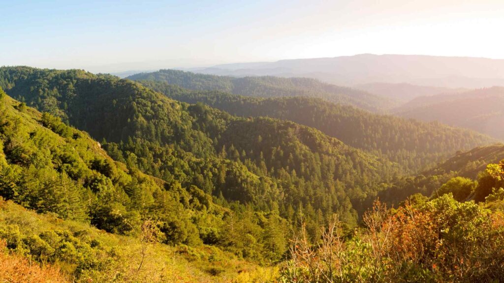
If you are looking for the best hikes in Santa Cruz that are longer, then the skyline-to-the-sea trail in Big Basin Redwoods State Park is the one for you.
Although you can complete this trek in a day, it would be hectic and tiring unless you are a frequent and experienced hiker.

One of the best hikes in Santa Cruz, this is a popular route for hikers, campers, and mountain bikers as it offers some of the most beautiful views of the Santa Cruz Mountains and the Pacific ocean.
The Skyline-to-the-Sea Trail starts at the ridge of the Castle Rock State Park and ends at Waddell Beach, on the shores of the Pacific Ocean.
Unlike the other trails, the skyline-to-the-sea hike does not go too deep into the forests.
You will be closer to the road but pass through some stunning landscapes on your hike, including the redwood and oak forests, meadows with coastal scrubs, mushrooms, Berry Creek Waterfall, creek crossings, and ponds, and finally, the gorgeous views of the Pacific Ocean.
It is best to spread the hike along this well-marked and maintained trail over two days with overnight camping for the best experience and splendid views on a weekend trip.
If you do not want to do the entire stretch, you can also do the shorter versions of this hike, thus making the skyline-to-the-sea trail ideal for people of all fitness levels.
You will want to arrange a ride or park a vehicle at both trailheads if in a group of two or more.
If you are camping overnight, you need to book your spot at campsites months before, including securing the necessary permits.
Also, check before embarking on this hike for road and trail closures due to rains and forest fires, frequent during the summer months.
SUNSET SKYLINE SHORT TRAIL
Distance – 2.9 miles
Difficulty – Easy
Duration – 2 hours
Type – Loop
If you do not want to make the longer skyline-to-the-sea trail, one of the easier trails in Big Basins Redwood Forest is the Sunset Skyline Short Loop.
It is one of the easy and pretty hikes in Santa Cruz. This three-mile hike is well-maintained and flat, ideal for people traveling with kids as it can be completed in just a little over two hours.

The Sunset Skyline Short Loop is also suitable for you if you do not want to spend a lot of time hiking but need to get the highlights of Big Basin Redwoods State Park.
The trail starts by crossing the footbridge at Opal Creek. It passes through the lowland redwood forest before making the ascent up Middle Ridge.
Once you reach the summit, follow the trail descending back down to the other side of the ridge, which will lead you to the Sunset Trail.
As the name suggests, this hike offers some gorgeous views of the sun setting over the Santa Cruz Mountains.
SEQUOIA TRAIL
Distance – 4.2 miles
Duration – 1.5 hours
Difficulty – Moderate
Type – Loop
The Sequoia Trail is one of the famous Santa Cruz hikes in Big Basin Redwoods State Park, a large park known for its expansive old-growth redwood forests.
If you are looking for easy hikes in Santa Cruz to witness some of the park’s most beautiful redwood forests, I recommend the Sequoia Trail.

As the name indicates, you will witness the beautiful Sequoia trees dominating the landscapes and the gorgeous wildflowers that carpet the land.
The Sequoia Trail, a four-mile loop, starts from the park’s Sequoia Campground along the edge of an ancient redwood forest.
Around halfway through your hike, you need to make a short descent to reach Sempervirens Waterfall, another 20-foot turquoise waterfall located amidst the dense forests plunging into the grotto.
It is one of the best waterfalls in the Santa Cruz area.

You will also come across some fascinating wildlife, including many colourful birds like woodpeckers, herons, egrets, and deer and squirrels.
There is a $10 for parking and entry. Since it is one of the popular hiking trails near Santa Cruz, get here early to start the hike early in the morning to stay ahead of the crowds.
BERRY CREEK FALLS HIKE
Distance – 12 miles
Duration – 4 hours
Difficulty – Difficult
Type – Loop
The Berry Creek Falls Loop is one of Big Basin Redwoods State Park’s most popular and beautiful hikes in Santa Cruz.

On this trail, you can visit the splendid Berry Creek Falls and witness the stunning forest canopy dotted with redwoods, creeks, streams, and abundant wildlife.
But unlike the other longer hikes, this 12-miles hike is ideal if you are an experienced hiker as the trail is challenging and steep with over 2000 feet of elevation changes.
But the difficulty does not stop the hundreds of hikers and mountain lovers that set on this adventurous hike to the beautiful waterfall.
The Berry Creek Falls Loop trailhead can be accessed from the big basin park headquarters. It is also the same place to start SunsetTrail and Skyline-to-the-Sea Trail, as both trailheads are nearby.
You will be rewarded with the lush greenery dominated by giant sequoia and redwood trees.

You will come across West Waddell Creek State Wilderness, and if you are lucky, you may spot some rare birds and beautiful wildflowers.
You will then descend into the canyon following Timm’s Creek trail & Sunset Trail, both considered challenging stretches, leading to Berry Creek, a gorgeous creek full of rapids and cascading smaller waterfalls.
After a few miles, you will climb out of the canyon, where you can enjoy the stunning panoramas of Monterey bay.

You need to hike back to Berry Creek Falls to enjoy the views of these splendid Falls. Spend some time admiring its splendour and capture its beauty on your lens while resting your tired legs.
Along with the general hiking attire, also carry a spare winter jacket as many sections of this trail are colder due to the lack of sunlight not penetrating the thick canopy of forests.
BEST HIKING IN SANTA CRUZ – HENRY COWELL REDWOODS STATE PARK
Parking – Paid parking lots, $10 per vehicle
Dog-friendly – No
Camping – Yes
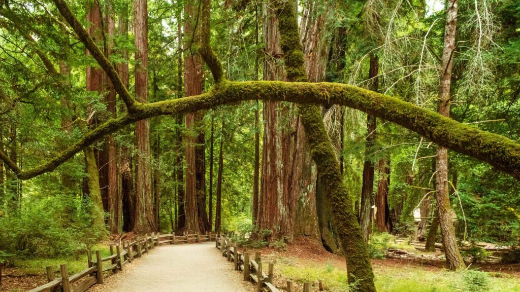
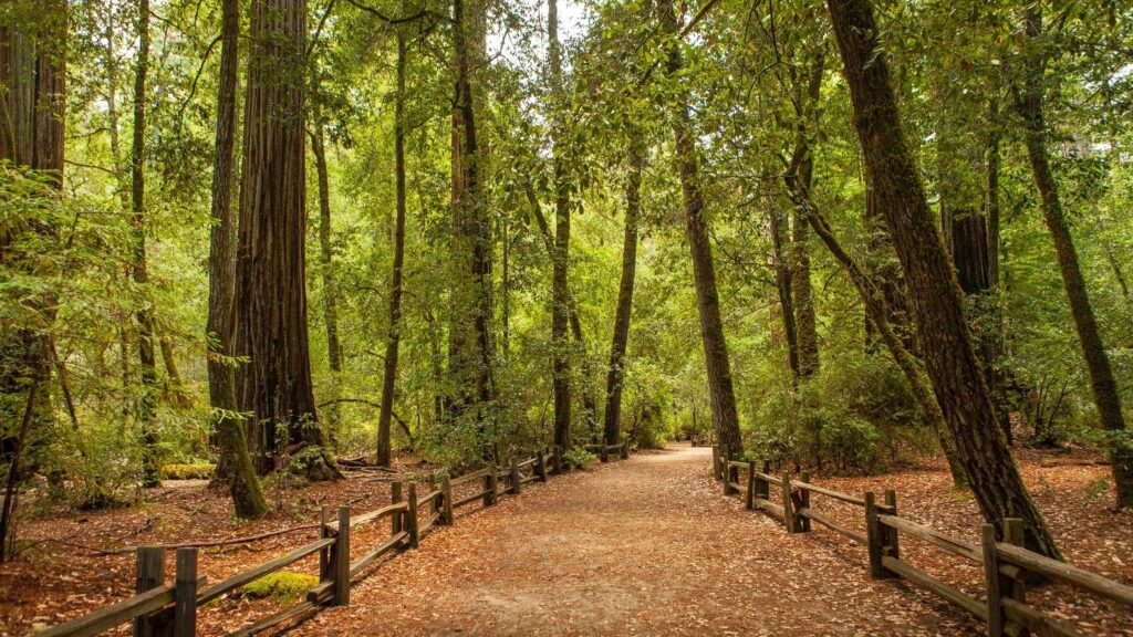
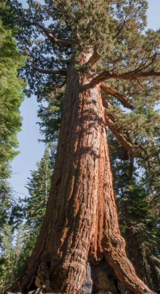
If you are exclusively planning to explore California’s best redwoods, Henry Cowell Redwoods State Park should be one of your top picks.
This vast expanse of the park, spanning 4650 acres located in the beautiful Santa Cruz Mountains, is blessed with rivers, waterfalls, caves, grasslands, swimming spots, and walk-in trees.

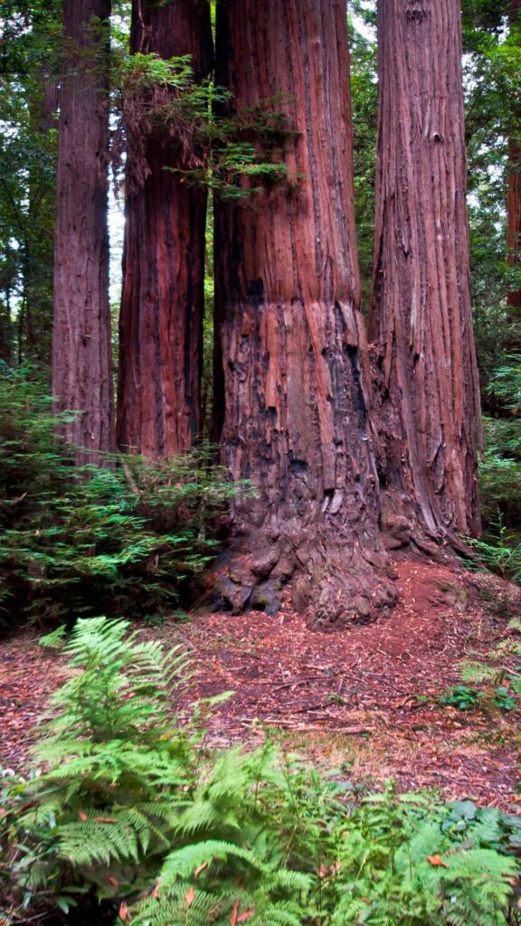
But the most notable icon of this state park is that it is home to over a 40-acre grove of ancient giant Californian redwoods, some of them at least over a thousand years old.
Apart from its abundant natural beauty, Henry Cowell Redwoods State Park has a rich past as it inspired some of the earliest redwood preservation efforts in California.
You can also witness some magical views looking out over the Santa Cruz Mountains on a few hiking trails in this park.

Besides hiking, bird watching, camping, mountain biking, and wild mushroom hunting are other popular things to do at Henry Cowell Redwoods State Park.
Experience the historic Roaring Camp Railroad by taking a ride on a Roaring Camp train, an open-air narrow-gauge steam locomotive from the 1890s, which is also a great way to learn about the park’s history.
FALL CREEK TRAIL
Distance – 6 miles
Duration – 3 to 4 hours
Difficulty – Easy
Type – Loop
Tucked away in the north of Henry Cowell State Park is one of the popular hikes in Santa Cruz mountains, the Fall Creek Trail.

It is an easy hike that follows Falls Creek through the heart of the state park, passing through the rugged old-growth redwood forest of Henry Cowell Redwoods State Park and connecting with many other trails.
Walking along the edge of this beautiful creek next to a lush forest canopy on this well-marked, shady trail is the best experience to enjoy with your kids.
This more extended day hike also has some historic features. Besides the redwoods, you will also spot ferns, madrone, and tanoak trees until you get to the ruins of the 19th-century lime kilns.
The out-and-back trailhead starts off Felton Empire Road at the Fall Creek Unit of Henry Cowell Redwoods State Park, a short drive north of the campground.
Be on the lookout for poison oak, common in the park.
CAPE HORN TRAIL
Distance – 3.5 miles
Duration – 1 to 2 hours
Difficulty – Easy
Type – Loop
If you are looking for an easy trail in Henry Cowell State Park, I recommend Cape Horn Trail, ideal for beginners and if you are traveling with young children.

The well-marked trail, which begins along Fall Creek Trail, offers you views of the redwood, mushrooms, ferns, and many birds. It is a good alternative if you do not want to do the longer and moderately difficult Fall Creek Trail
Cape Horn Trail can also be accessed from the end of the South Fork Trail.
REDWOOD GROVE LOOP TRAIL
Distance – 0.8 miles
Duration – 2 hours
Difficulty – Easy
Type – Loop
Although it is a concise trail, one of the best hikes in Santa Cruz takes you through the iconic old-growth redwoods found in Henry Cowell State Park.
It is flat and an easy trail which is perfect for doing with kids and ideal for all experience levels.
You will also come across the famous Fremont Tree on this short loop. The Fremont Tree, which has big hallows, gets its name as it was once the home of John Fremont.
Do carry your headlamp to see when you step inside this tree.
The Redwood Grove Loop Trail trailhead is conveniently located near the main parking lot and nature centre.
You can reach Red Groove Loop from Santa Cruz Beach Boardwalk, seven miles away.

The many 250-feet tall old-growth redwoods also shade the path, some of the tallest, most comprehensive and also among the oldest in California, providing a quick introduction to the rich forests of Henry Cowell State Park.
You’ll also cross over a few pretty creeks and witness the unique wildlife on the hike. You need to pay $10 for parking and entry.
OTHER HIKING TRAILS NEAR SANTA CRUZ
MOUNT MADONNA COUNTY PARK
If you want quick and easy access to many beautiful trails, Mount Madonna County Park has some of the amazing hiking trails in Santa Cruz.
Running for over 14 miles, there are plenty of trails passing through redwood forests, grassy meadows, and creeks, where you can look for wild mushrooms, enjoy bird watching, or have a picnic.

The park is also famous for mountain biking and camping, especially during the summer and fall seasons. There is also an amphitheatre where regular screenings happen. You need a small fee to enter the park.
SARATOGA GAP AND RIDGE TRAIL, CASTLE ROCK STATE PARK
Distance – 11 miles
Duration – 5 hours
Difficulty – Moderate
Type – Loop
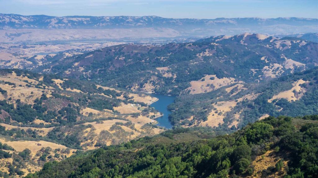
Castle Rock State Park is a gorgeous park located on the edges of the Santa Cruz mountains, and it encompasses over 5,000 acres of rugged terrain.
It is a famous park among hikers, mountain bikers, campers and backpackers, thanks to over 30 miles of lush trails offering diverse views, activities and attractions for everyone.

The Saratoga Gap and Ridge Trail Loop is a moderate hike located in Castle Rock State Park, which is considered one of the best hikes in Santa Cruz to explore the top attractions in the park.
You will be rewarded with the stunning views of Castle Rock Falls and watch the unique sandstone formations of Castle Rock and Goat Rock on this moderately difficult trail.
It is mostly easy but falls into a moderate category due to the steep sections in between, which are best tackled with good hiking shoes,
You will also spend half a day on this trail, passing through some of the thick canopies of forests that give glimpses of dramatic cliffs, cross creeks, climb rocks and witness rocky ridges spanning 5000 acres, making Castle Rock one of the best state parks in California.
The Saratoga Gap Trail, a 4.8-mile loop, starts at the main park entrance and follows the Castle Rock Trail.
From there, you’ll begin descending the Saratoga Gap Trail.
The Saratoga Gap Trail is carpeted with moss trees and boulders covered in lichen.
Spot the many unique sandstone formations. Also, do not miss the beautiful views of the San Lorenzo River.
This trail merges with the Skyline-to-the-Sea trail. You can go back here or continue further until Castle Rock Trail Camp, where you can camp if you have the permits and the stay secured before the trek.
You need to pay a parking fee of $10 per car at the Castle Rock park main entrance.
Recommended: 30 Spots For The Best Views In Yosemite National Park California
POGONIP CREEK NATURE LOOP, POGONIP OPEN SPACE
Distance – 1.6 miles
Duration – 3 hours
Difficulty – Moderate
Type – Out and Back
A popular mountain biking trail, Pogonip Creek Nature Loop is also an excellent trail for hiking due to its short distance.
It is one of the best hikes in Santa Cruz, located just about 3 miles up from the Santa Cruz Boardwalk, and connects UC Santa Cruz and Henry Cowell Redwoods State Park.
Although Pogonip is a smaller park, this 640 acres of the forest offers the best views of meadowlands, rolling hills, and wildflowers scattered around 8 miles of trail, providing a fantastic experience of hiking in Santa Cruz.
This trail also connects with many other tracks, so you can extend your hike to cover more spots.
If you hike northwest from Pogonip, you will reach Brayshaw Trail. You can easily access Spring Trail, walk to the Lime Kiln Trail, or towards Box Spring Trail.
There is also the Prairie Trail and the woodland Fern Trail. Beware of the poison oak and mountain lions on these trails.
SIERRA AZUL PRESERVE OPEN SPACE
One of the best places for hiking near Santa Cruz is driving to Sierra Azul Preserve Open Space, which is about a 40-minute drive away from Santa Cruz.
Sierra Azul is a beautiful park that is ADA accessible and kid-friendly, offering over 15 miles of stunning hiking trails and Mount Umumhum, one of the tallest peaks in the Santa Cruz Mountains.
There is no entry fee, and there are also many spots for a relaxed picnic lunch at Sierra Azul.
You can combine a day trip to San Jose from Santa Cruz and a hike in this park that offers gorgeous views of its diverse forests comprising oak, fern, chaparral, canyons, and creeks.
The park is also a popular spot among mountain bikers and bird watchers.
MANRESA STATE BEACH
If you are looking for a perfect mix of mountains and beaches, Manresa State Beach offers many hiking trails near Santa Cruz.
Manresa is popular for camping, mountain biking and hiking. Many beautiful coastal walks allow you to tidepool, enjoy a picnic along the beach, do bird watching, and even camp.
Do not miss the stunning views of the dramatic cliffs and panoramas of the Monterey Peninsula.
I recommend spending the evening here as the sunset views are surreal, overlooking the ocean and rocky cliffs.
Restrooms and showers are available not far from the parking area. Note that there is a fee for entry and parking.
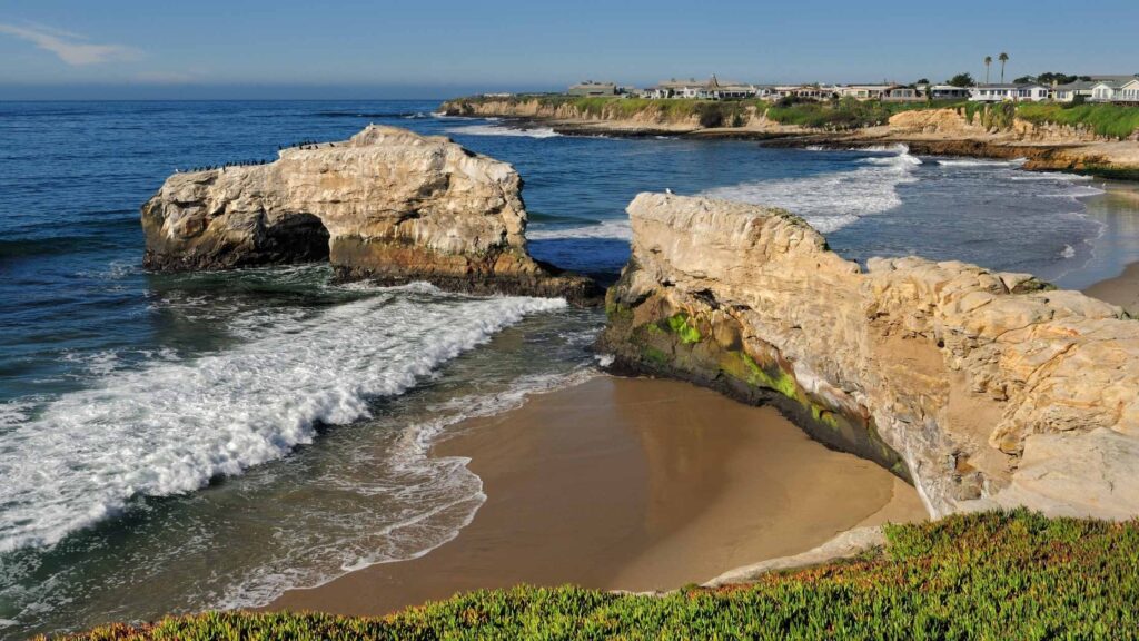
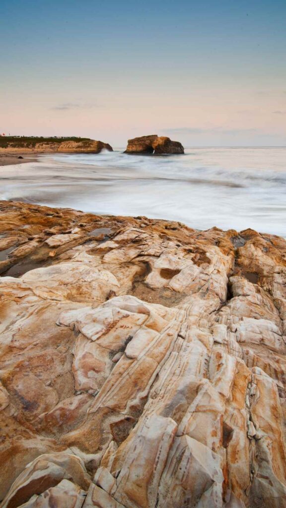
MONARCH TRAIL, NATURAL BRIDGES STATE BEACH
Distance – 0.6 miles
Duration – 1 hour
Difficulty – Easy
The Monarch Trail is a short, easy hike located in Natural Bridges State Beach.
It is one of the best hikes in Santa Cruz as it is family-friendly and ideal for a stroll.
Since the trail is less than a mile long, it can be completed in about 30 minutes. You can easily add it for a quick stop.
The Monarch Trail, one of the easy Santa Cruz hikes, passes through a beautiful eucalyptus grove offering stunning views of the park’s beaches and the Pacific Ocean.
However, the main attraction of the trail is the wildlife, especially Monarch Butterflies.
From late fall to winter months, which is the best time to do this hike, a fluttering sea of black and orange butterflies flock around the lush eucalyptus groves at the Natural Bridges State Beach as they migrate into this area.
It is a beautiful sight to behold as they colour the landscapes. You can also watch other animals and rare birds in the park.
COTONI COAST DAIRIES NATIONAL MONUMENT
A vast expanse of over 6,000 acres along the coast of Santa Cruz County forms the Cotoni-Coast Dairies National Monument, a protected natural landscape comprising diverse terrains, ranging from the redwoods to the coastal shore.
It is located north of Wilder Ranch and spans from the San Vincente Redwoods down to the shoreline.
The reserve offers many miles of rugged trails for hikers, campers, and mountain bikers to explore the many pretty beaches, beautiful views of the coast, giant redwoods, meadows, waterfalls, caves, and creeks.
You can also access the park through booked tours, including hikes. For more information, check the Bureau of Land Management site.
BEST HIKES IN SANTA CRUZ – DELAVEAGA PARK
Parking – Free parking lot inside either entrance
Camping – No
More popular among the locals than the tourists, some of the excellent trails for hiking in Santa Cruz can be found at DeLaveaga Park, which is more than a natural park.
From golf to baseball to archery to playgrounds and picnic areas, there are a lot of activities you can enjoy, especially with kids.

The park also has dog-friendly hikes in Santa Cruz, where you will also spot mountain bikers and local day hikers.
Choose your trail at this park depending on your available time and interests.
Beware of poisonous oak and mountain lions in the area in the wilderness.
LA CORONA TRAIL
Distance – 3.5 miles
Duration – 1 hour
Difficulty – Easy
Type – Out and back/Loop
Among the popular trails in DeLaveaga Park is La Corona Trail, which is ideal for beginners and families.
The trail features beautiful redwoods and viewpoints, offering stunning views. You can also spot the banana slugs and stop at the disc golf course.
La Corona Trail is the best hike at the park to give you a good overview of the beautiful landscape and flora and fauna that can be found at DeLaveaga Park.

You will begin the hike from the trailhead that starts near the main parking lot. There is a gradual incline as you climb through the redwood forest to arrive at a beautiful lookout point at the top.
You can take the same way to head back or take the Branciforte Creek Trail to go near the creek and enjoy different views from the park.
If you love museums, the surfing museum is a great stop. There are many viewpoints from which you can watch the beautiful sunset on this walk.
If you have time, I recommend staying for these vibrant views. Make sure to carry a wind jacket, though, as it gets cold in the evening.
USEFUL TIPS FOR HIKING IN SANTA CRUZ
Here are some of the things to know while hiking Santa Cruz.
Watch out for poison oak and ticks – Poison Oak is rampant in Santa Cruz County, especially along all the trails, along with ticks and other insects. Do not touch any plants and it is best to wear long trousers even during the summer to avoid contact with poison oak.
Cell Service is not great everywhere – On some hikes in Santa Cruz, there is limited or no cell service, so it is best to plan accordingly
Download maps for offline use – Due to limited cell service and inaccurate GPS, it may be difficult to navigate. It is best to carry offline or physical maps wherever possible
Carry cash, and snacks – Some places may not accept credit cards, especially in parking lots. So carry cash. The same goes for snacks and drinks. Carry sufficient snacks like protein bars, fruits and nuts for munching as there are no amenities.
Check for road closures and forest fires – Due to forest fires, some trails get closed. It is best to check online for information about the current status of the hiking trails before you plan your trip. The same goes for roads if you are driving in the area.
Do not miss the cute banana slugs – One of the top wildlife attractions in Santa Cruz County is the banana slug that can be found in and near the redwood trees. Watch out for these bright yellow slugs on your hikes.
Carry layers – It is surprising how many underestimate or do not take into account the chilly evenings in Santa Cruz. No matter what time of the year, dense forest trails and mountain top areas are cold and windy as the evening sets in. So make sure to carry a warm wind jacket with you.
The best months for hikes in Santa Cruz – May through October are the popular months for enjoying hiking near Santa Cruz. But if you want fewer crowds, I would suggest the shoulder months of spring and fall.
WHAT TO PACK FOR HIKES IN SANTA CRUZ?
For a hassle-free experience of hiking in Santa Cruz, it’s important to pack properly.
Depending on the time of year, you will need to modify the list of the below items according to the temperatures.
If you’re visiting in the winter, rain is very common, and so is fog during the California mist season. Here’s a list of things you will need.
GENERAL ITEMS
- Hiking Boots
- Camping Sleeping Bag
- Wind Jacket
- Day pack
- Backpack
- Pocket-Sized Water Filter
- Reusable food storage bags
- Ultralight First Aid Kit
- Hiking Leggings
CLOTHING
The temperatures can be foggy during the day and they drop at night as the breeze increases.
As with camping anywhere, you need to be prepared for the unpredictability by going with many layers. Here’s what you need:
- Base Layer – Long Sleeve Sun-Protected Light Weight Top + Light Weight Hiking Pants
- Insulating Layer – Light Weight Pullover
- Outer Layer – Light Weight Windproof jacket with hood or Insulating Light Weight Jacket for fall/winter weather.
CAMPING ESSENTIALS
Here are some of the camping essentials you will need:
- Cooler for food and water – Ultra Travel Cooler
- Camping Chair – Quad Camping Chair
- Camping Cot – Folding Camp Cot and Air Bed with Side Tables and Battery Operated Pump
- Sleeping Bags – Brazos Cold Weather Sleeping Bag
- Sleeping Tents – Ultralight Tent 3-Season Backpacking Tent 1 Person/2 Person Camping Tent
- Camping Lantern – Rechargeable LED Camping Lantern
- Backpack – Hiking Day Pack and Reusable Water Bottle + Light Weight Water Filter
Camping essentials for preparing food:
The best one I’d recommend is this Outdoor Master Cook Portable Folding Camp Kitchen along with this Light Weight Cook Ware and Backpacking Gas Stove Burner.
OTHER ESSENTIALS
Even if you aren’t into photography, you may want to bring a camera with a good lens.
I own a Panasonic LUMIX DC-ZS70S that I carry while camping since I prefer lightweight gear instead of my Nikon D850 which I use regularly.
WHERE TO STAY IN SANTA CRUZ?
If you are not camping, you will need to stay in Santa Cruz at least for a few nights, especially if you plan to do multiple hikes.
Here are some of my recommendations in all budget ranges:
Close to the beaches
If you are looking to be right across the beach, my favourite recommendations would be Beach Street Inn and Suites, across from Main Beach.
If you prefer something elegant, go for West Cliff Inn, A Four Sisters Inn, a stunning 3-story Victorian home just steps from the Santa Cruz Beach and Boardwalk.
For couples and people traveling with kids, I recommend La Quinta Inn & Suites by Wyndham Santa Cruz located in the city centre.
For mid-budget hotels, go for Hampton Inn Santa Cruz West, conveniently located 1.8 km from the Natural Bridges State Beach.
Carousel Beach Inn, located a 2-minute walk away from the Santa Cruz Beach Boardwalk is also another excellent option.
I hope this guide on the best places to hike in Santa Cruz will help you to have an adventurous hiking trip. If you need more info, do let me know in the comments or write to me.
MORE HIKING GUIDES IN CALIFORNIA

- Why the Philippines is Becoming the iGaming Hub of Asia - May 24, 2026
- Cultural Immersion: Guided Paths into the Heart of a Destination - December 18, 2025
- The Best Destinations for Your First Solo Package Holiday - December 18, 2025


