
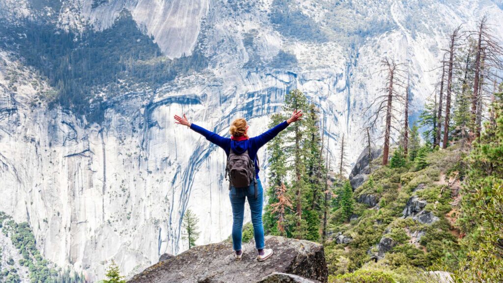
Are you looking for the best South Bay Hikes? I got you covered. Thanks to my many weekend getaways throughout the year, I have been able to hike many trails in South Bay.
In San Jose, you are spoiled for choice when hiking outdoors.
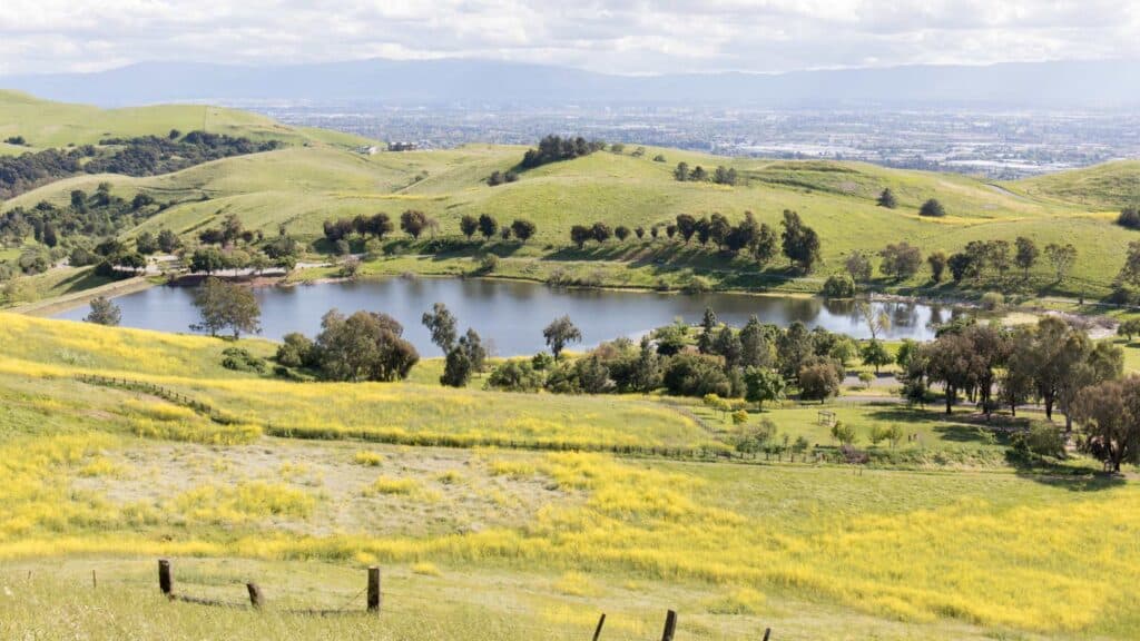
From great redwood forests to beautiful lakes and meadows adorned with stunning wildflowers, you can get on one of the South Bay hiking trails to admire splendid panoramic views, including sunsets.
I have enjoyed all the trails as they are not unique but also enjoyable, with some being dog-friendly and many of which you can plan with your kids.
Whether planning a weekend on the trails with your family or an easy and short hike, check out these best hikes in San Jose.
WHAT TO PACK FOR BEST SOUTH BAY HIKES?
CONTENTS
GENERAL ITEMS
- Hiking Boots
- Camping Sleeping Bag
- Wind Jacket
- Day pack
- Backpack
- Pocket-Sized Water Filter
- Reusable food storage bags
- Ultralight First Aid Kit
- Hiking Leggings
CLOTHING
The temperatures can be foggy during the day and drop at night as the breeze increases.
As with camping anywhere, you must be prepared for unpredictability by going with many layers. Here’s what you need:
- Base Layer – Long Sleeve Sun-Protected Light Weight Top + Light Weight Hiking Pants
- Insulating Layer – Light Weight Pullover
- Outer Layer – Light Weight Windproof jacket with hood or Insulating Light Weight Jacket for fall/winter weather.
CAMPING ESSENTIALS
Here are some of the camping essentials you need:
- Cooler for food and water – Ultra Travel Cooler
- Camping Chair – Quad Camping Chair
- Camping Cot – Folding Camp Cot and Air Bed with Side Tables and Battery Operated Pump
- Sleeping Bags – Brazos Cold Weather Sleeping Bag
- Sleeping Tents – Ultralight Tent 3-Season Backpacking Tent 1 Person/2 Person Camping Tent
- Camping Lantern – Rechargeable LED Camping Lantern
- Backpack – Hiking Day Pack and Reusable Water Bottle+ Light Weight Water Filter
Camping essentials for preparing food:
The best one I’d recommend is this Outdoor Master Cook Portable Folding Camp Kitchen along with this Light Weight Cook Ware and Backpacking Gas Stove Burner.
OTHER ESSENTIALS
Even if you aren’t into photography, you may want to bring a camera with a good lens. I carry a Panasonic LUMIX DC-ZS70S while camping since I prefer lightweight gear to my Nikon D850, which I use regularly.
They even provide monthly insurance, much required for slow travellers like me!
TIPS FOR BEST SOUTH BAY HIKES
Check if the trails are open when you visit – Although the parks may be open to visitors, many sections and roads are closed as seasonal.
So check the park website for road closure details and the latest updates.
Best time to visit – The most preferred time for the best hikes in South Bay are the spring, early summer, and fall months, and since both are popular seasons, you can expect lots of crowds.
Check the weather – Before planning your trip and arriving, keep tracking for any weather changes to plan your South Bay hikes.
Haze, fog, and winds make it unwise to wait until the evening. Do not hike if the weather is terrible, such as storms or high winds.
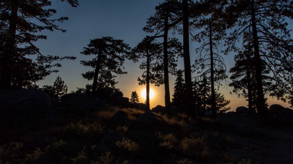
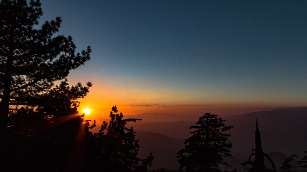
Look up sunset times before you go – To time for the best photos and shots, look up the sunset timings at the specific location you plan to be.
Intermittent or no cell service – Some of these hiking trails in South Bay have limited or no cell service, so plan your trip accordingly.
Download all maps – Before you do the best South Bay hikes, download all the details you need, including all the attractions, maps to all the spots, parking lots and other things, to your phone as there is limited cell service.
Carry a Headlamp – Bring a headlamp or flashlight as you will hike back after sunset, and it will be dark. You will need it for places where the trail can be rocky apart from the dark.
Arrive Early for Sunsets – Being late means you will look for parking and make your way through the crowds, which will take away many minutes of the golden hours.
Plan to book well in advance, even on off-seasons – Whether you go camping or stay in lodges, hotels or apartments, you must book in advance while planning your South Bay hikes if you wish to stay overnight in the nearby campgrounds.
Lodge reservations are released a year before, and within a few weeks, they tend to get filled for the peak months. You need to check the timings and book at least more than six months before.
The same goes for campgrounds, for which the reservations are released six months before. You need to book your accommodation for a summer trip at the start of the year, and you can make all reservations via Recreation.Gov.
Beware of wildlife – Although most of the time it is not dangerous, sometimes encountering bears, snakes, and other wild animals can prove dangerous. So do not wander off the designated trails.
BEST SOUTH BAY HIKES
ALMADEN LAKE LOOP
- Distance: 1.3 miles
- Difficulty: Easy
- Elevation: 36 feet
- Pets: On the Leash on the East side of the Park
If you are looking for the best South Bay Hikes with a gorgeous lake around, visit Almaden Lake Loop, located in the heart of San Jose adjacent to the Almaden Expressway.
This massive 4,000-plus acre park is home to 35 miles of a rugged network of hiking trails and has rich mercury mining history.
Almaden Quicksilver County region was once home to miners, and today, you can witness the remains of mining operations on various trails.

You can take multiple routes to cover the Almaden Lake Loop.
The Lake Almaden trail, a 1.3-mile loop that runs around the lake, is relatively flat and occupied mainly by joggers and evening stroll lovers.
There is a short section at Coleman Avenue where you must cross an overbridge to exit the park and return to the trail if you want to make the whole loop.
The views of the well-maintained Almaden Lake and the sounds of the birds chirping in the lush trees are a perfect combination for a refreshing morning jog.
Recommended – 25 Best Hikes In Santa Cruz For Outdoor Lovers
If you take the Los Alamitos Creek Trail, you will notice the newly constructed bridge. Since the park is so big, you will end up in junctures of several trails at many points.
Check out the nearby Hacienda Entrance to hike the English Camp and Deep Gulch Trails.
These two trails run parallel and have a mild elevation gain.
At the end of these trails, you will reach the significant conjuncture of other courses like the Castillero and Mine Hill Trail.
Several historical remnants are worth visiting along these trails to learn about the area’s historical significance. Also, you can use them as your pitstops to take a break from hiking.

Check out the Rotary Furnace, Hangman’s Tree, San Cristobal Tunnel, Buena Vista Shaft and many other historical places along the way.
Don’t miss to check out the rustic wooden bridge along the new Almaden trail.
If you want more fun, reach the park’s central area to take the Quicksilver History Trail, one of the trails in Almaden with several loop hike options.
Get your pups on a leash only on the park’s east side. The park’s West side is a Wildlife Sanctuary, home to many vibrant birds, squirrels, rabbits and other animals. So pups aren’t allowed on this side.
Check out the cosy beach area near the lake to unwind and have a lazy sunny day by the beach.
Note that all the trail around the lake is wheelchair-friendly. Well-maintained public restrooms and parking are available.
HUNTERS POINT
- Distance: 9 miles
- Difficulty: Moderate
- Elevation: 500 feet
- Pets: On leash
Hunter’s Point, located in the Fremont Older Open Space Preserve in Santa Clara County, Southwest of San Jose, is one of the famous South Bay Hikes.
Fremont Older Open Space is home to 14 miles of gorgeous trails, suitable for all types of hikers.
The rustic courses run through vast grasslands and oak woodlands with guard rails and benches for people to linger.
Hunter’s Point can be accessed via multiple entrances. The shortest is up Regnart Road via Regnart Trail, which is quite steep but takes around 15-20 minutes to reach the point.
But my favourite is the trailhead at the Prospect Road parking lot.
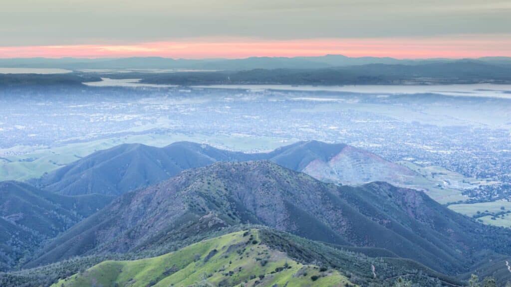
Quite a lengthy route, but it is relatively flat and offers some of the best views of the Bay Area.
On a clear day, you might even get distant views of San Francisco.
Take the Cora Older Trail from the Prospect Road entrance and hike towards Hunter Point.
You will see a network of trails at this point, each offering stunning mountain ranges vistas.
If you want a quick top view from a better vantage point, continue hiking on the Hayfield Trail to reach the Lookout point and witness stunning views of the Santa Clara Valley.
The trail is also home to wildlife, including deer, rabbits and coyotes. If you are a bird-watching enthusiast, get a pair of binoculars to spot vibrant birds.
Hike further on the Coyote Ridge Trail to reach Maisie’s Peak, another higher vantage point with gorgeous views. The trail also connects the adjacent Stevens Creek County Park.
ALVISO SLOUGH TRAIL
- Distance: 9 miles
- Difficulty: Easy
- Elevation: 72 feet
- Pets: No
One of the gorgeous South Bay hikes is the Alviso Slough Trail in Alviso Marina County Park which winds through salt marshes and tidal channels of South Bay.
Located next to Don Edwards San Francisco Bay National Wildlife Refuge, Alviso Slough Trail offers a unique opportunity to explore the region’s natural habitats and observe various wildlife.

The trail is relatively flat throughout and runs miles on top of the water. Get your hats on since the path is open without shade.
Alviso Slough Trail can be accessed via the trailhead, which starts from the picnic area and goes up North. Follow the signages.
You can either complete the entire Alviso Slough Trail, about 9 miles loop that runs along the salt ponds or take the shorter Mallard Slough Trail.
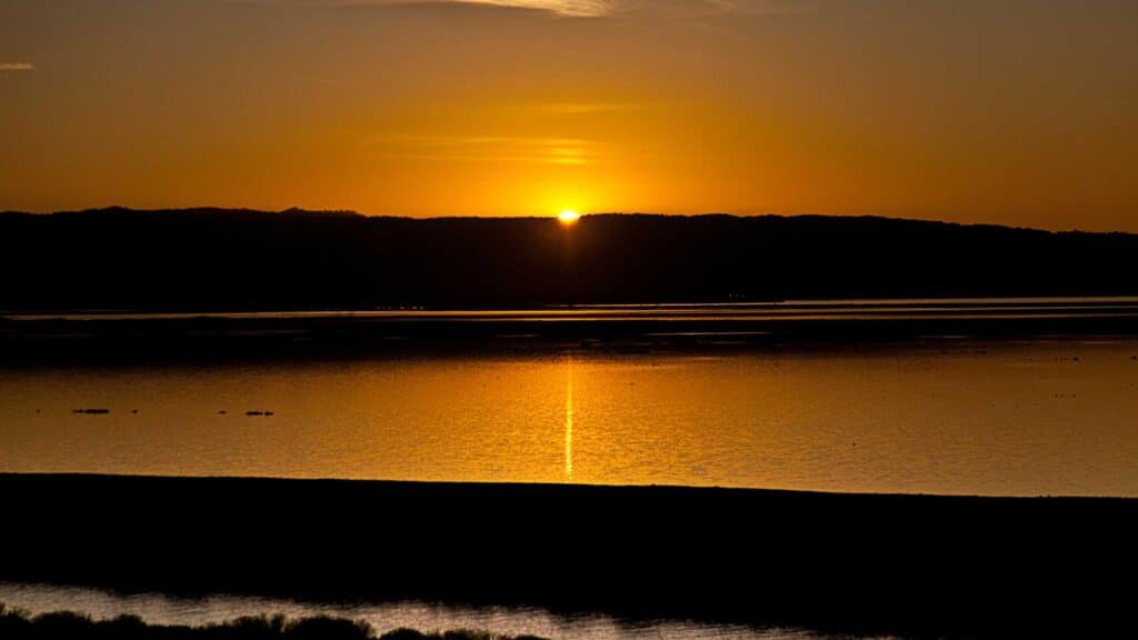
The trail is closer to the main city, like San Jose, so you will see that joggers and evening strollers will mainly occupy it. Go there to get a glimpse of a stunning Sunset.
Alviso Slough Trail is wheelchair friendly. If you are a bird lover, take a pair of binoculars to spot birds like pelicans, eagles, kites, hawks and ospreys.
BALD PEAKS TO SERPENTINE LOOP
- Distance: 4.1 miles
- Difficulty: Moderate
- Elevation: 1100 Feet
- Pets: No
Bald Peaks to Serpentine Loop is one of the gorgeous South Bay hikes, suitable for experienced hikers.
The entire trail is partially shaded, and you will be rewarded with stunning views of cascade mountains and the surrounding wilderness.
The hike begins at Bald Peaks trailhead and winds through a well-maintained trail leading you to the incredible Bald Peaks views. Take a break there and enjoy the surrounding vistas.
The trail connecting to the Serpentine Loop is steep and rugged at specific points.
It navigates through the lush forest, and you will witness the vibrant Californian poppies, especially during the spring.
Are you a fan of Californian poppies? Check out my post on flower fields in California.
Coming back to the Bald Peaks to Serpentine Loop, you need to take a slight detour on the Bald Peaks trail towards Canada Del Oro Trai, which runs about a mile and eventually connects to the Figueroa Trail.
Continue up North on Figueroa Trail to connect to Serpentine Loop trail.
The terrain, ranging from rocky to muddy forest floors, gets interesting.
Watch out for poison ivy as you hike the trail, and be prepared for a good amount of calorie burn.
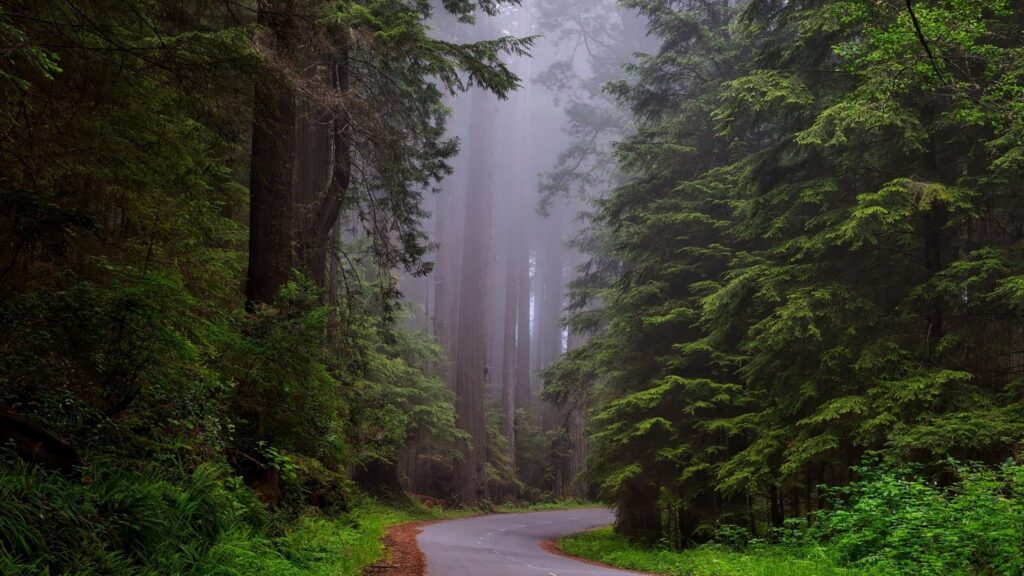
ALMA TRAIL VIA REDWOOD SPRINGS TRAIL LOOP
- Distance: 5.7 miles
- Difficulty: Easy
- Elevation: 1000 feet
- Pets: No
Some of the gorgeous South Bay Hikes are located in the Bear Creek Redwoods Open Space Preserve in Los Gatos, Alma Trail via Redwoods Spring Loop.
The trail is popular among hikers, joggers, nature lovers and horseback riders. It navigates through dense forest, and the trail is mainly dotted with towering redwoods.
The first half of the trail is moderate because of the elevation gain, but the latter part gets easy with some mild inclines.
Stop by the Old Growth Redwoods in bear creek along the way to appreciate the beautiful redwoods. Enjoy a picnic lunch under the shades of giant redwoods.
Try horseback riding on this trail. Alma trail via Redwood Springs Loop usually gets crowded since it is very near Highway 17. So start your hike early during the day.
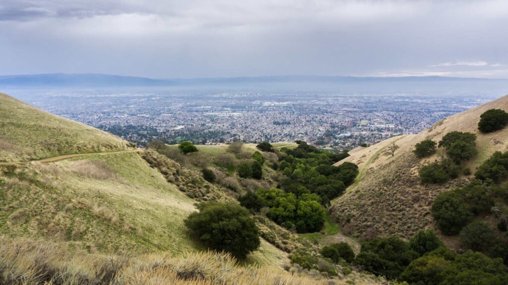
AQUILA TRAIL
- Distance: 1.2 miles
- Difficulty: Easy
- Elevation: 129 Feet
- Pets: No
If you are looking for fantastic South Bay Hikes, head to Sierra Vista Open Space Preserve, a massive 1,600 acres adorned with woodlands and grasslands.
The varied terrain is home to a network of many beautiful trails.
One of my favourites is the Aquila Loop Trail, a 1.2-mile loop which navigates through lush fields and offers excellent mountain views.
Aquila Loop is a relatively easy and flat trail, suitable for all types of hikers.
There are benches along the trail for resting. This loop is mainly known for its fantastic sunset views.
You might find the trail and the benches crowded, especially during evenings and on a clear day. Take in the beautiful views of the nearby cities like San Jose.
If you are an avid hiker looking for more adventure, check out the other beautiful trails like Sierra Vista Trail on the East and the Boccardo Loop Trail on the West side of the park.
MOUNT UMUNHUM TRAIL
- Distance: 3.4 miles
- Difficulty: Moderate
- Elevation: 1000 feet
- Pets: No
In Santa Cruz, in the Sierra Azul Open Space Preserve, Mount Umunhum Summit Trail, next to the Almaden Quicksilver County Park, is one of the beautiful South Bay Hikes.
The entire preserve is home to many trails and gains an elevation of about 3,486 feet.
But you can still get modest views of the surrounding region from Mount Umunhum Summit Trail.
To access the 3.4 miles trail, look for the trailhead signages near the Bald Mountain Parking Area.

You will witness a paved path which gains an elevation of about 1000 feet that leads you to the top of the summit.
Visit the Mount Umunhum Radar Tower or stop by the Guadalupe Creek Overlook to witness the beautiful distant views of the waters gushing in the Guadalupe Creek.
Check out the other historical attractions like the exclusive Ceremonial Space built in the name of the indigenous peoples whose cultures are tied to Mount Umunhum region.
EAGLE ROCK
- Distance: 3.3 miles
- Difficulty: Easy
- Elevation: 177 feet
- Pets: On Leash
Head to Alum Rock Park on the Northeast of the Golden State, a 720-acre stunning landscape, home to 13 miles of gorgeous hiking trails in South Bay.
The park runs along the Upper Penitencia Creek area, adding charm to the hiking scene.
Horseback riding, mountain biking and picnicking are popular activities in this area.

Out of the several hiking trails, a popular and easy path is Eagle Rock, which offers incredible views of the park and is open to all non-motorized trail users.
Though the trail looks challenging at first glimpse, you will find it easy, well-maintained and worth the hike since you will be rewarded with blissful views.
The trailhead is on the front entrance of Alum Rock County Park at 15350 Penitencia Creek Road. For a shorter alternative, start from Eagle Rock’s first Parking Lot.
The trail runs through swaths of forests, and the sounds of the flowing waters of the creek and the birds chirping in the backdrop is a bliss.
Take the Penitencia Creek Trail into the park, following the creek.
Continue on Penitencia Creek Trail until you reach the road. Take the Lariat Trail uphill before turning right onto the North Rim Trail.
At the fork, turn left to continue to the summit on the Eagle Rock Trail.
The summit has multiple vantage points to take in the sweeping views.
Relax on the benches and enjoy the pleasant breeze and the sunset views.

You might wonder why this place is called Eagle’s Rock; you will notice the red-tailed hawks soaring in the sky, a beautiful sight.
Head back down via the North Rim Trail and join the Lariat Trail, and take a right to return to the parking lot to explore a different route.
On a clear day, you can see into the San Francisco peninsula. Basic toilets are available. Get a hat on since the weather can keep changing at this place.
BAY VIEW TRAIL
- Distance: 3.8 miles
- Difficulty: Easy
- Elevation: 750 feet
- Pets: On Leash
If you want some of the best hikes in South Bay, California, visit Coyote Hills Regional Park, which has 1,266 acres of rolling hills along the eastern shore of San Francisco Bay in Fremont.
Coyote Hills Regional Park is known for picnicking, bird-watching, biking and hiking.

There is a network of gorgeous paved hiking trails, of which the Bayview trail is my favourite.
The 3.8-mile Bayview Trail loop is relatively flat and suitable for all hikers. The trailhead is at the entrance of the Park near Paseo Padre Parkway.
The Bayview Trail runs through most of the park and connects several other routes in the Coyote Hills for various adventures.
This trail is one of the last wetland refuges amidst the urban sprawl of the Bay Area.
You will witness many spectacular birds like migrating waterfowl, orioles and kites.

The marshland area is home to many rodents. On the Bayview Loop trail, you will be greeted with the views of ducks and geese wading in the shallow waters of the south end of San Francisco Bay.
Check out the Alameda Creek Trail, which runs along the park’s north side. This 12-mile multi-use trail connects Fremont to San Francisco Bay.
If you have spare time, visit Quarry Lakes Regional Recreation Area, approximately five miles away, East of the park.
COYOTE PEAK TRAIL
- Distance: 4.9 miles
- Difficulty: Moderate
- Elevation: 337 feet
- Pets: On Leash
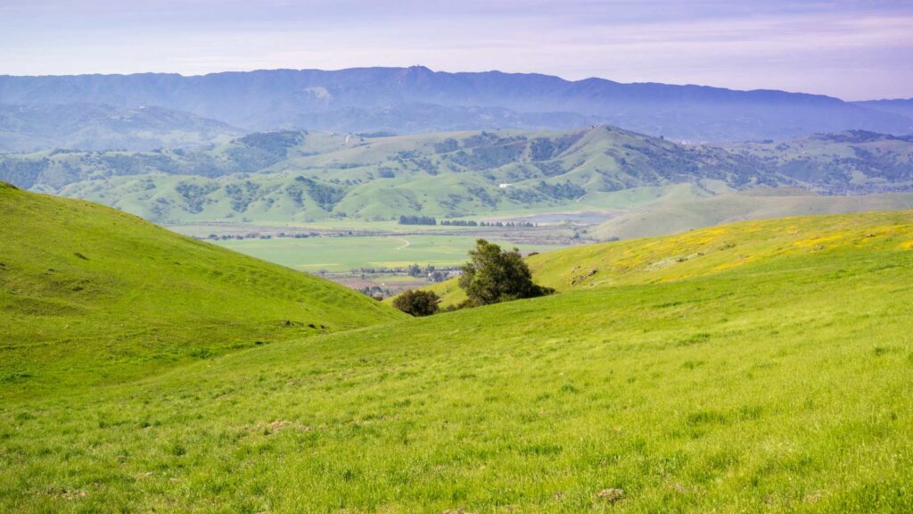
If you want South Bay area hikes, visit Santa Teresa County Park, a 20-minute drive south of downtown and home to 18 miles of stunning South Bay hikes.
The park is known for Coyote Peak, 1,155 feet summit which can be reached via various trails.
If you want to take a moderate route, head to the Pueblo Day Use Area trailhead and navigate the steep Rocky Ridge Trail to connect with the Coyote Peak Trail.
Follow the Coyote Peak Trail and a summit spur trail to take in the gorgeous views of the peak and the surrounding Santa Clara County.
Head back via the Hidden Spring Trail, which makes a loop back to the parking area.
You will witness carpets of California poppies sprout around at the end of March or the beginning of April.
If you want a more adventurous hike, you can customize your trail routes using the nearby Ridge or Ohlone trails.
Restrooms and water are available at the Pueblo Day Use Area. You need to buy a parking ticket for $6.
COYOTE CREEK TRAIL
- Distance: 15 miles
- Difficulty: Moderate
- Elevation: 640 feet
- Pets: Off Leash
Located in the Hellyer County Park, Coyote Creek Trail is one of the most extended South Bay hikes, which runs along Coyote Creek and stretches from the Santa Clara County border to the Pacific Ocean.
It is a haven for hikers, bikers, joggers and horseback riders.
The 15-mile trail starts from the Northern End at the Bay Area ridge trail near the San Francisco Bay and then passes through Hellyer County Park, San Jose, before ending at the Southern end near Anderson Lake County Park.
Along the trail, you can see a mix of various environments, including Urban and Natural settings.
You may spot deer, coyotes, many species of birds, wildflowers and oak trees.

Coyote Creek trail passes through beautiful attractions, including the Olympic size Hellyer Velodrome, where you can rent a track bike for $10 and go for a race.
Stop by the beautiful Cottonwood Lake to spot ducks and turtles floating around and many colourful birds. Check your golf skills at the Los Lagos Golf Course.
The park also has many wooden structures, a kids’ play area and an exclusive off-leash dog park near the Hellyer Velodrome.
Well-maintained restrooms are available at a couple of points along the trail.
LISA KILLOUGH LOOP TRAIL
- Distance: 5 miles
- Difficulty: Moderate
- Elevation: 750 feet
- Pets: No
Visit Calero County Park if you are looking for south bay hiking trails.
The park, located in Santa Clara County, is spread over 4,400 acres and offers various activites.
The park’s main draw is the Calero reservoir, dotted with 19 miles of rustic trails that meander through beautiful oak woodlands, chaparral and riparian habitats, making it one of the gorgeous South Bay Hikes.
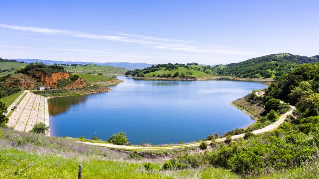
The reservoir is also a hotspot for fishing, motorized and non-motorized boating.
One of the locals and my favourite hiking trails is the 5-mile Lisa Killough Loop Trail.
The trailhead starts at the Rancho San Vicente Entrance in the park’s northwest corner and over grassy hills, which are golden in the summer and bright green in the wet winter months.
Lisa Killough Loop trail ends at the junction of the Cottle Trail.
Stop at Lisa’s lookout point to enjoy a picnic lunch and, at the end of the trail, take in the gorgeous views of the Calero reservoir.

Hike during spring to see vibrant wildflowers dotting these trails.
Also, wear a hat and wear clothes in layers since most of the trail is not shaded.
If you are an avid hiker looking for more South Bay area hikes, hike the Serpentine Loop, which takes you deeper into Calero County Park or take the Cottle Trail, which runs along the reservoir’s banks for about 8 miles.
WILDCAT LOOP TRAIL
- Distance: 3 miles
- Difficulty: Easy
- Elevation: 850 feet
- Pets: No
Check out the Rancho San Antonio Open Space Preserve in Cupertino if you want beautiful South Bay Hikes.
The preserve is home to around 24-miles of gorgeous hiking trails, of which the 3-mile Wildcat Loop trail is one of the most popular.
The trailhead for the Wildcat Loop starts at the point less than a mile from the Deer Hollow Farm (landmark- a restroom).
The path until this point is filled with gravel and could be more enjoyable.
A few meters away from the restroom, you will enter a forest area and witness several creeks on the way, which is the beginning of the Wildcat Loop.
The trail is easy with a slight elevation gain, you will get beautiful views atop a ridgeline, and if you travel during the spring, you will be greeted with a carpet of vibrant wildflowers.
Looking for women’s footwear for hiking?
Wildcat Loop trail connects with the Rogue Valley Trail before returning to Deer Hollow Farm.
If you have spare time, explore other adventurous hiking trails like the Stephen E.Abbors Trail and the 9-mile Black Mountain Trail.
MORE SOUTH BAY HIKES
DEER HOLLOW FARM LOOP
- Distance: 2.7 miles
- Difficulty: Easy
- Elevation: 250 feet
- Pets: No
Another famous South Bay Hikes in the Rancho San Antonio Open Space Preserve is the Deer Hollow Farm Loop.
Deer Hollow Farm is also one of the best hikes near San Jose since it is a short family-friendly hike and easily accessible.
You can access the Deer Farm via two routes. One is via the main parking areas at Rancho San Antonio Open Space, which take the paved Lower Meadows Trail, and the other alternative is to take the single-track Coyote Trail.
The Lower Meadows Trail is much flatter and accessible for all hikers, including wheelchairs.
You can combine both trails, less than 3 miles, to add more fun to your hike.
Enjoy a picnic lunch at the farm and explore the century-old barnyard buildings. Play with baby goats, and watch chickens and other livestock.
Many rustic picnic benches are available on the farm, apt for a perfect day hike trip.
PENITENCIA CREEK TRAIL
- Distance: 3.5 miles
- Difficulty: Easy
- Elevation: 262 feet
- Pets: No
One ideal family-friendly South Bay hike is the Penitencia Creek Trail, located in the Alum Rock Park in the Eastern foothills of San Jose.
The trail is easy and runs along Penitencia Creek, a relaxing experience, especially if you are from a noisy city.
The closest trailhead is near the Mineral Springs parking lot in Alum Park.
Hike on the Penitencia Creek Trail and follow the creek until the trail loops around and joins with the South Rim Trail.
About halfway down, you will see the fork point of the trail.

If you are short on time, take the steeper Switchback Trail to return to the parking lot or continue down the South Rim Trail for a longer hike.
The South Rim trail will eventually connect with the Woodland Trail, which is also relatively flat and shaded.
The Penitencia Creek Trail also connects the two trailheads of the North Rim Trail.
There are several spots on this trail to sit back, soak in the beauty of the surrounding oaks, and take in the sounds of the gorgeous flowing creek.
Get a pair of binoculars. You might spot some rare birds in the area.
Stop at the Wildlife Center of Silicon Valley in Berryessa Park to learn more about the importance of local flora and fauna.

You will also pass by the Youth Science Institute. The Penitencia Creek Trail also connects some unique points like the Inspiration Point Loop.
If you are still trying to reach the 3.5-mile out-and-back Penitencia Creek Trail, try the shorter Mineral Springs Loop.
On this trail, you will cross a stone footbridge and witness remnants of the bathhouse that stood here.
Since the whole hike is an uphill section, try to get enough water and other beverages, carry a hat, and hike in the more excellent month or during the early morning of the summer.
SOUTH BAY HIKES MAP

- Why the Philippines is Becoming the iGaming Hub of Asia - May 24, 2026
- Cultural Immersion: Guided Paths into the Heart of a Destination - December 18, 2025
- The Best Destinations for Your First Solo Package Holiday - December 18, 2025


